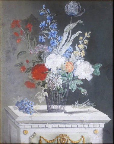
School of Barbara Regina Dietzsch (1706-1783), Flower Bouquet with Grasshopper
School of Johannes Bronckhorst (1648-1727), [Bird Perched on a Branch in a Rocky Landscape]
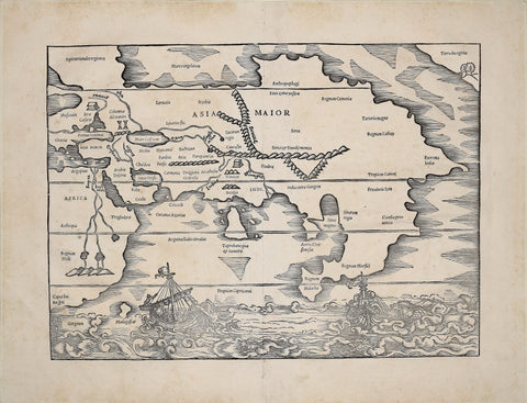
Sebastian Munster (1488-1552), Asia Major
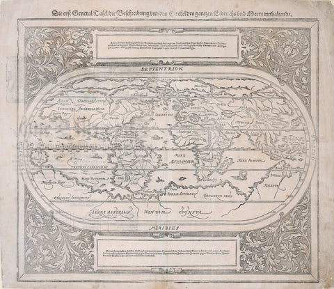
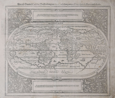
Sebastian Munster (1488-1552), Die erft General Tafel..
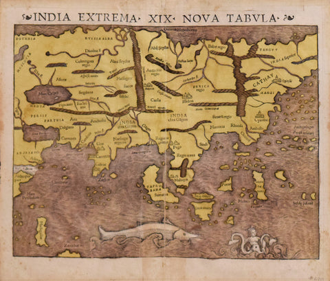
Sebastian Münster (1488-1552), India Extrema XIX Nova Tabula
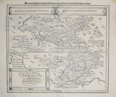
Sebastian Munster (1488-552), Die Newen Infeln...
Sebastian Munster (German, 1488-1522), La Ville insulaire de Lindaw...[Landau, Switzerland]
Sebastian Munster (German, 1488-1552), Die Erst General Tafel die Beschreibung
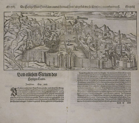
Sebastian Munster (German,1488-1552), Die Heylige Statt Jerusalem…
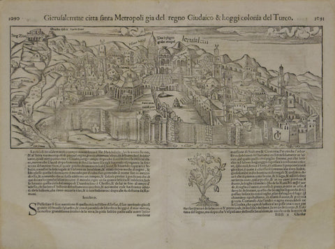
Sebastian Munster (German,1488-1552), Gierusalemme citta fanta Metropoli... (Jerusalem)
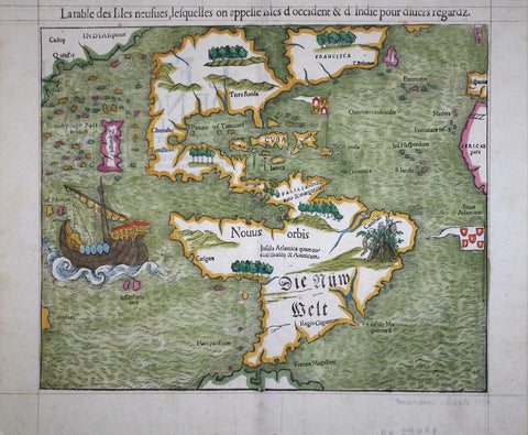
Sebastian Munster (German,1489-1552), La table des Isles neufues...
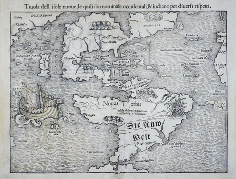
Sebastian Munster (German,1489-1552), Tavola dell’isole nuoue...
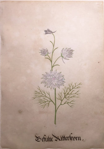
Sebastian Schedel (German, 1570-1628), Befulte Kitterwern
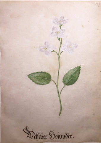
Sebastian Schedel (German, 1570-1628), Belcher Hohinder
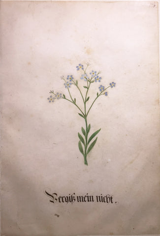
Sebastian Schedel (German, 1570-1628), Berqus Mein Nicht
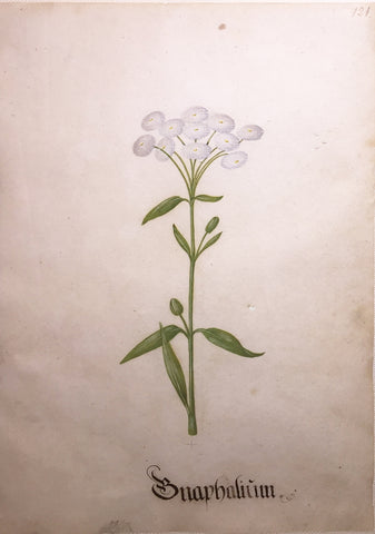
Sebastian Schedel (German, 1570-1628), Bnaphalium
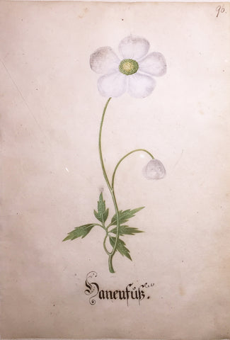
Sebastian Schedel (German, 1570-1628), Haneufub
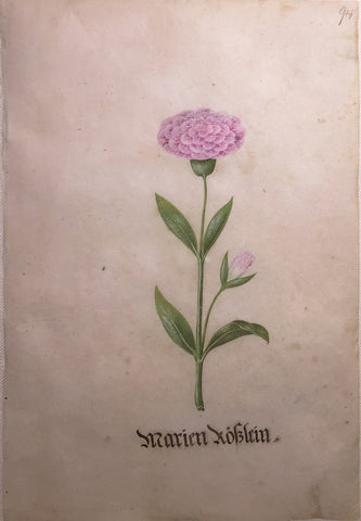
Sebastian Schedel (German, 1570-1628), Marien Koblein
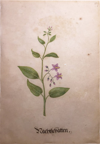
Sebastian Schedel (German, 1570-1628), Nachtelchatten
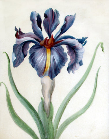
Sebastian Schedel (German, 1570-1628), Purple Iris
![School of Johannes Bronckhorst (1648-1727), [Bird Perched on a Branch in a Rocky Landscape]](http://aradergalleries.com/cdn/shop/products/schoolofbronckhorst_BirdPerchedonaBranchinaRockyLandscape_large.jpg?v=1603478462)
![Sebastian Munster (German, 1488-1522), La Ville insulaire de Lindaw...[Landau, Switzerland]](http://aradergalleries.com/cdn/shop/products/La_ville_insulaire_de_Lindaw-_Basel_large.jpg?v=1475090947)