A.J. Johnson, California, Utah. Nevada, Colorado, New Mexico, and Arizona
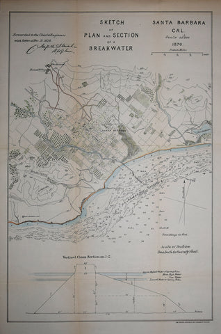
Am. Photo-Lith. Co, Sketch of Plan and Section of a Breakwater, Santa Barbara, Cal., 1870
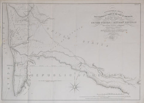
Andrew B. Gray, Topographical Sketch of the Southernmost Point of the Port of San Diego
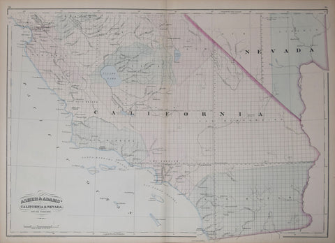
Asher & Adams, Asher & Adams’ California & Nevada, South Portion
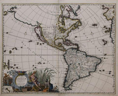
Carel Allard (Dutch, 1648-1709), Recentissima Novi Orbis Sive Americae Septentrionalis et Meridionalis Tabula ex Officina Caroli Allard...
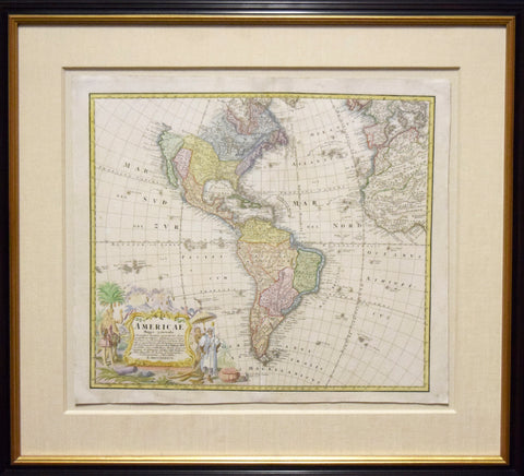
D.J.M. Hasaii, Americae Mappa Generalis...
Department of the Interior, Administrative Map of Yosemite National Park, Edition of 1910 [California]
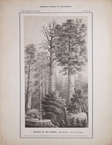
Edward Vischer (1809-1878), Mother of the Forest, (1855 and 1861) and other Groups, Plate IV
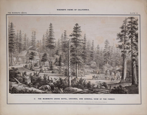
Edward Vischer (1809-1878), The Mammoth Grove Hotel, Grounds and General View of the Forest
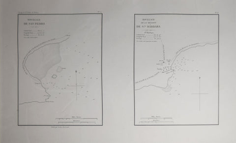
Eugene Duflot de Mofras (1810-1884), Mouillage De San Pedro. No. 12 (with) Mouillage De La Mission De Sta. Barbara. No. 13
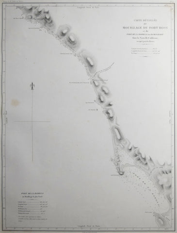
Eugene Duflot de Mofras (1810-1884), Carte Detaillee du Mouillage du Fort Ross et du Port de la Bodega ou Romanzoff
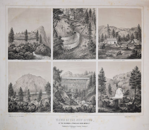
F. Holtzman, Drawn from Nature, Views of the New Ditch, of the Columbia & Stanislaus River Water Co.
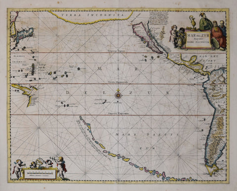
Frederick De Wit (1630-1706), Magnum Mare del Zur cum Insula California
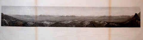
Frederick W. von Egloffstein (1824-1885), artist, Valley of Humboldt River at Lassen's Meadows
Jan Janssonius (Dutch, 1588-1664) , Mare del Zur Hispanis Mare Pacificum
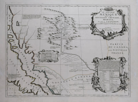
Jean Baptiste Nolin (French, 1686-1762) & Vincenzo Maria Coronelli (Italian, 1650-1718), Le Nouveau Mexique appele aussi Marata, avec Partie de la Californie…
Jean François de Galaup, comte de Lapérouse (French, 1741-1788) 2 Charts, Part of the Pacific Ocean between California and Philippine Islands
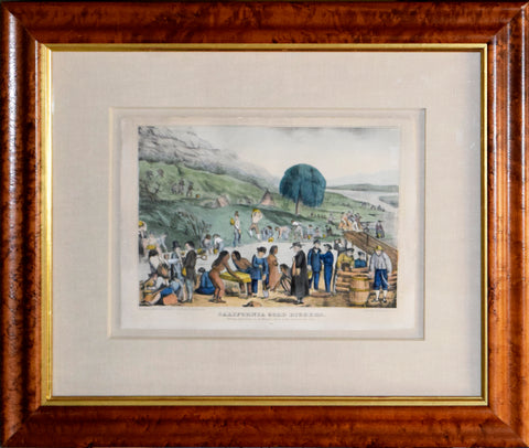
Kelloggs & Comstock (1849-1852), Publisher, California Gold Diggers
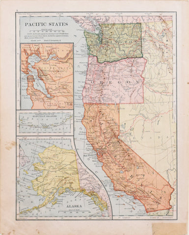
L.L. Poates Engineering Company, Pacific States
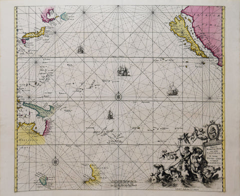
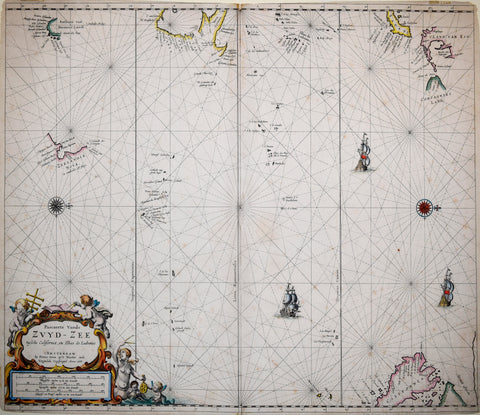
Pieter Goos ( ca. 1616-1675), Pascaerte Vande ZVYD - ZEE tussche California

![Department of the Interior, Administrative Map of Yosemite National Park, Edition of 1910 [California]](http://aradergalleries.com/cdn/shop/products/yosemitenp1_large.jpg?v=1614274216)