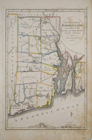
Caleb Harris & Harding Harris, The State of Rhode Island
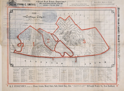
Drawn by A. L. Bodwell; Map of the Cottage City, Martha’s Vineyard, 1-Oak Bluffs, 2-Camp Ground, 3-Vineyrad Highlands
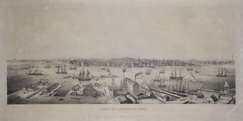
Edwin Whitefield (1816-1892), View of Boston 1848. From East Boston.
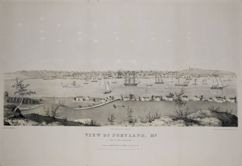
Edwin Whitefield (1816-1892), View of Portland, ME., from Cape Elizabeth side
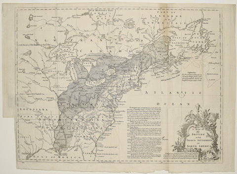
Gentleman’s Magazine, A Map of the British and French Settlements in North America
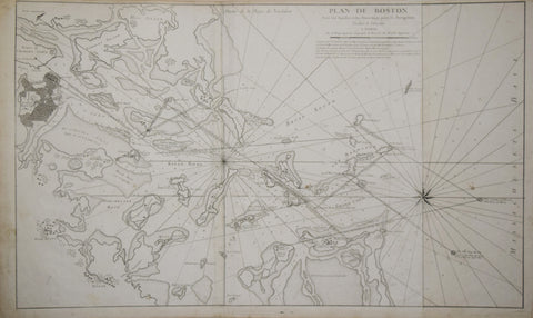
Georges Louis Le Rouge (1712-1790), Plan de Boston avec les Sondes et les Directions pour la Navigation
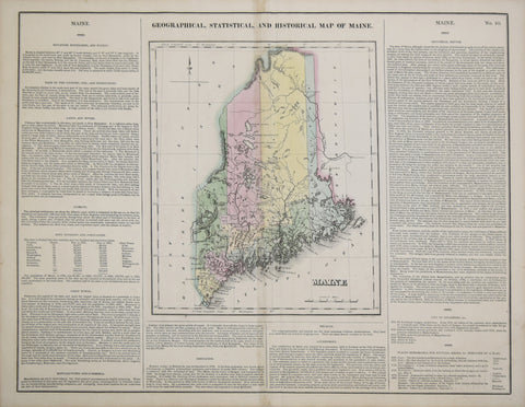
Henry C. Carey (1793-1879) & Isaac Lea (1792-1886), Geographical, Statistical and Historical Map of Maine
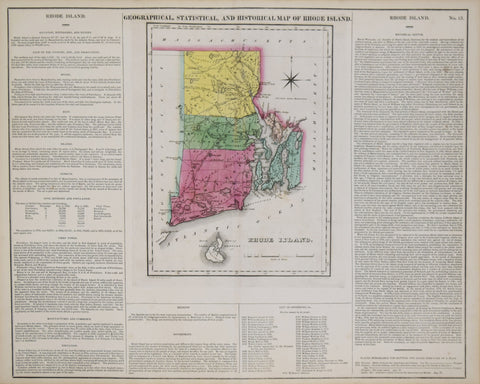
Henry C. Carey (1793-1879) & Isaac Lea (1792-1886), Geographical, Statistical and Historical Map of Rhode Island
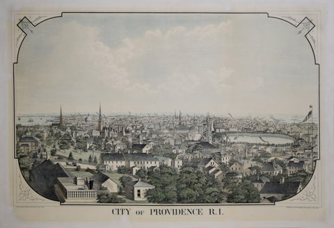
Herbert S. Packard & J. Schwegler, City of Providence, R. I.
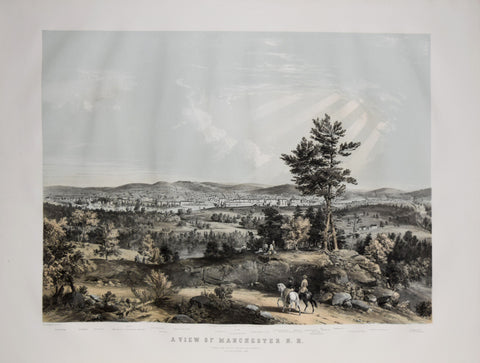
J. B. Bachelder, A View of Manchester, N. H., composed from Sketches taken near Rock Raymond by J. B.
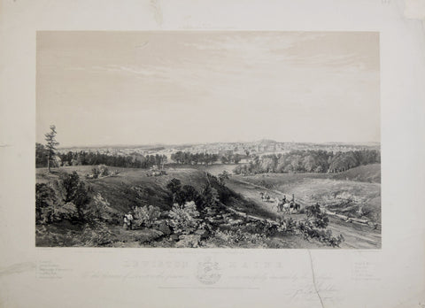
J. B. Bachelder, Lewiston Maine, from the Residence of Isaac Haskell (Prospect Hill)
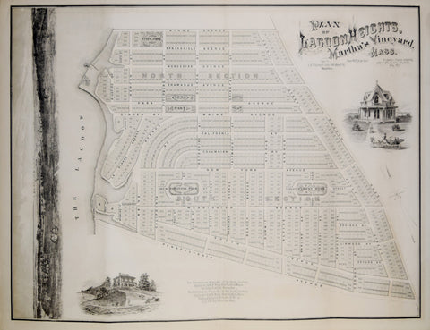
J. H. Bufford’s Lith., Plan of Lagoon Heights Martha’s Vineyard, Mass.
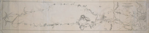
James Hayward (1786-1866), Plan of a Survey for the Proposed Boston and Providence Rail-Way
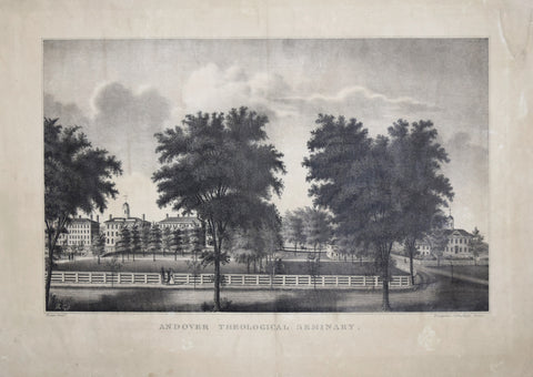
James Kidder (1793-1837), Andover Theological Seminary
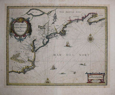
Joannes Jansson (Dutch, 1588-1664), Nova Anglia Novum Belgium et Virginia
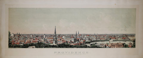
John H. Bufford (1810-1870), Providence from Prospect Terrace 1877
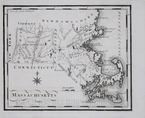
Joseph Scott, Massachusetts
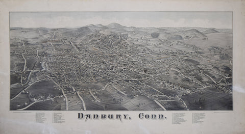
Lucien R. Burleigh, Danbury, Conn.
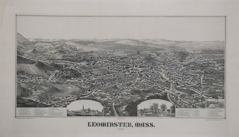
Lucien R. Burleigh, Leominster, Mass. 1886.
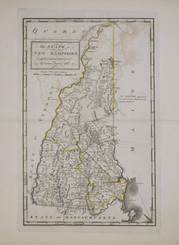
Mathew Carey (1760-1839), The State of New Hampshire compiled chiefly from actual Surveys by Samuel Lewis, 1813