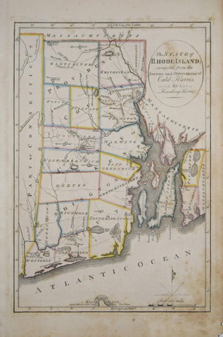
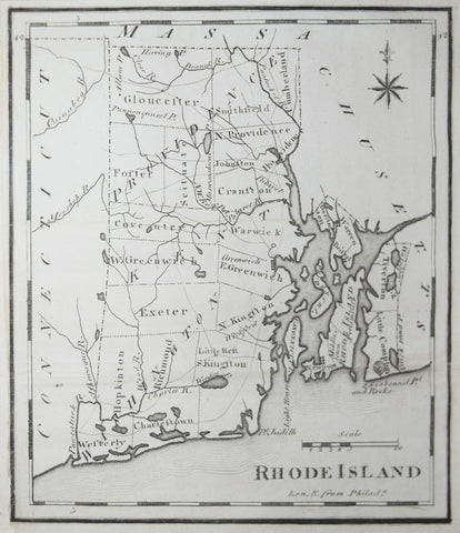
Caleb Harris & Harding Harris, The State of Rhode Island
Drop-leaf or Dining Table, Newport, Rhode Island, 1780-95 (Inv. 0348)
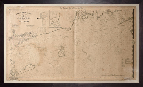
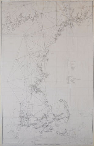
George W. Eldridge, Ge. W. Eldridge's Chart B New London to Gay Head, 1903
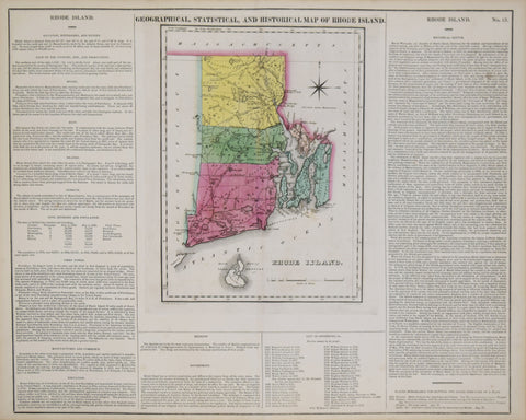
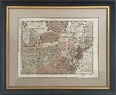
Henry C. Carey (1793-1879) & Isaac Lea (1792-1886), Geographical, Statistical and Historical Map of Rhode Island
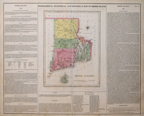
Henry Charles Carey (1793-1879) & Isaac Lea (1792–1886), Geographical, Historical and Statistical Map of Rhode Island
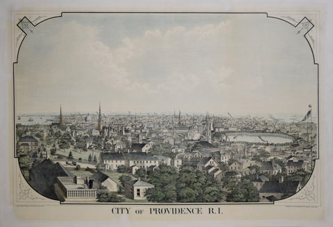
Herbert S. Packard & J. Schwegler, City of Providence, R. I.
James Hayward (1786-1866), Plan of a Survey for the Proposed Boston and Providence Rail-Way
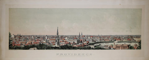
John H. Bufford (1810-1870), Providence from Prospect Terrace 1877
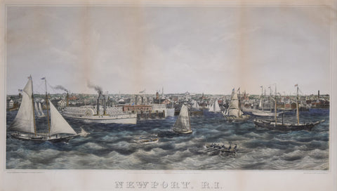
John Perry Newell (1832-1898), Newport, RI
Joseph Scott, Rhode Island
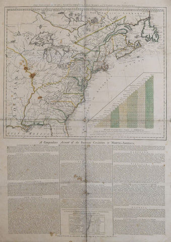
Lewis Evans (1700-1756), A General Map of the Middle British Colonies, in America...
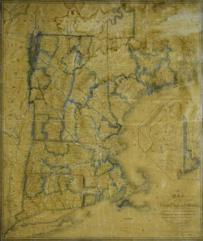
Nathan Hale (1784-1863), A Map of the New England States, Maine, New Hampshire, Vermont, Massachusetts, Rhode Island, Connecticut With the adjoining parts of New York & Lower Canada
Robert Sayer (1725-1794) & John Bennett (d.1787) publishers, The Theatre of War in North America, with the Roads and Table of Distances…
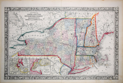
Samuel Augustus Mitchell (1790-1868), County Map of the States of New York, New Hampshire, Vermont, Massachusetts , Rhode Island and Connecticut
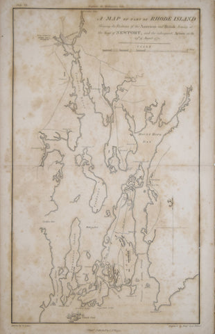
Samuel Lewis (1753-1822), A Map of part of Rhode Island Shewing the Positions of the American and British Armies at the Siege of Newport..1778
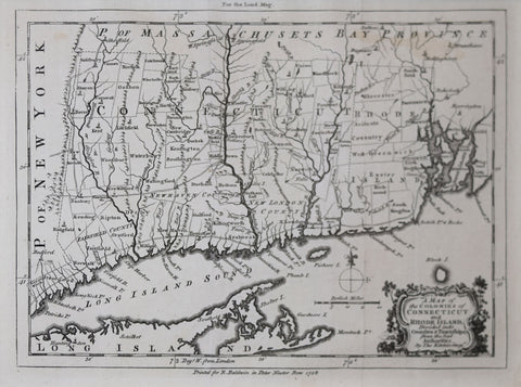
Thomas Kitchin (1718-784), A Map of the Colonies in Connecticut and Rhode Island, Divided by Counties and Townships…
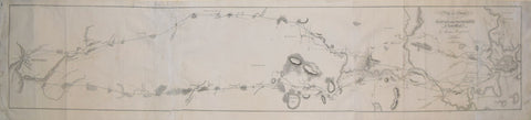
U.S. Coast Survey/A.D. Bache, Sketch A Showing the Progress.. Section No. 1 from 1844-1853