Captain James Cook (1728-1729) and John Webber (1751-1793)
Captain James Cook (1728-1729) and John Webber (1751-1793)
A Voyage to the Pacific Ocean. Undertaken, by the Command of his Majesty, for making Discoveries in the Northern Hemisphere to determine The Position and Extent of the West Side of North America; its Distance from Asia; and the Practicability of a Northern Passage to Europe . . . In Three Volumes. Vol I and II written by Captain James Cook, F.R.S. Vol. III by Captain James King, LL.D. and F.R.S.
London, 1784.
Engravings
Chronicling the greatest of all eighteenth-century explorations, these splendid engravings from volume three of a first edition set of Captain Cook’s A Voyage to the Pacific Ocean pictorially document this famous adventurer’s amazing journey. For the first time, they presented to the world scientific and ethnographic data, pictorial representations, and cartographic discoveries of the Pacific from its northern reaches to its southern extremities. Cook's fateful third voyage was a search for the Northwest Passage, during which he was killed by the once friendly natives of Hawaii, and thus the third volume of his celebrated work was started by him and completed by Captain James King.
On July 12th 1776, Captain Cook’s third voyage began with the Resolution leaving England and its partner ship the Discovery behind. The Discovery’s unfortunate Captain Clerke had been imprisoned for debt, after agreeing to act as guarantor for the payment of his brother’s arrears, and it took two weeks to secure his release. The two ships were later to be reunited at Cape Town, South Africa. While Cook sailed under the direction of the Royal Navy, he had volunteered rather than been requested to complete the mission. The Admiralty was reluctant to burden him with the exertions of yet another dangerous journey and thus Captain Cook resolved to offer his services.
This voyage was different to his previous two, however. Britain was at war as its American colonies fought for their own sovereignty. The Declaration of Independence had been signed on 4 July, just eight days before the Resolution sailed, and the already perilous journey was now also in danger of capture from American pirates ready to hold the vessels hostage on their voyage home. It is notable that Benjamin Franklin, American Minister to the court of France, wrote a letter requesting free passage for Cook, as a mark of respect for the man himself and also in recognition of the importance of the journey’s mission.
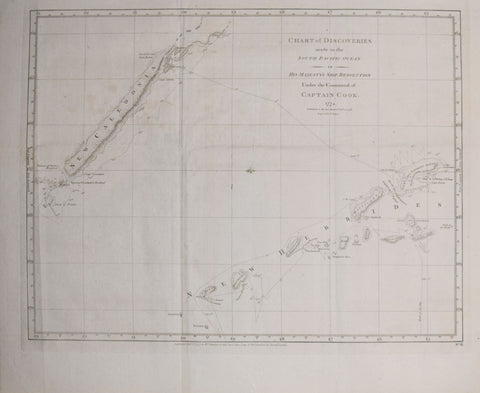
Notably, that mission was primarily navigation and exploration of a Northwest Passage and not scientific and anthropological study, which is remarkable when study of the engravings is made. The maps were drawn by Lieutenant Henry Roberts, under the direction of Cook, and in the General Chart the Captain’s three voyages are charted. In a letter dated 18 May 1784, Robert’s wrote: “Soon after our departure from England, I was instructed by Captain Cook to complete a map of the world as a general chart, from the best materials he was in possession of for that purpose; and before his death this business was in a great measure accomplished. . . “
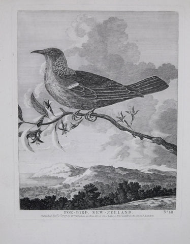
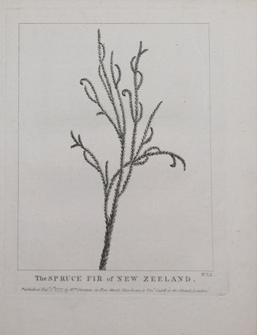
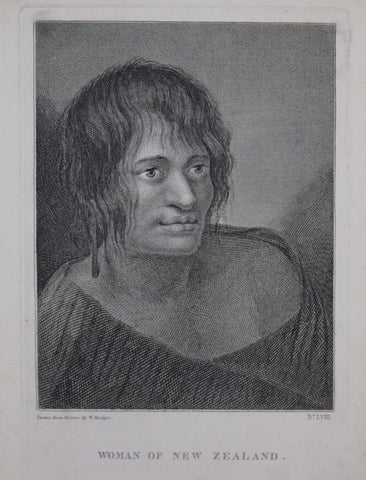
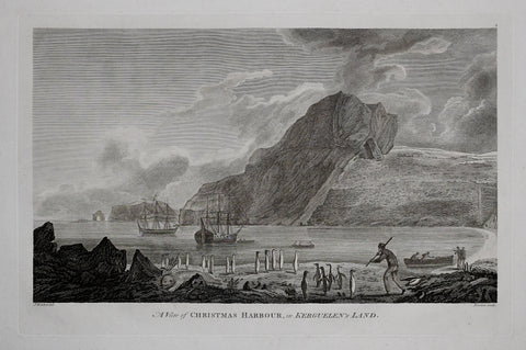
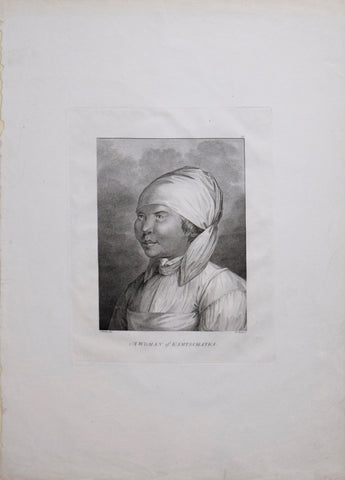
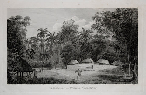
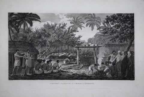
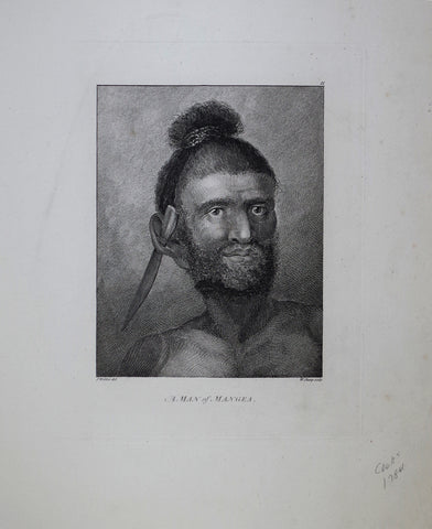
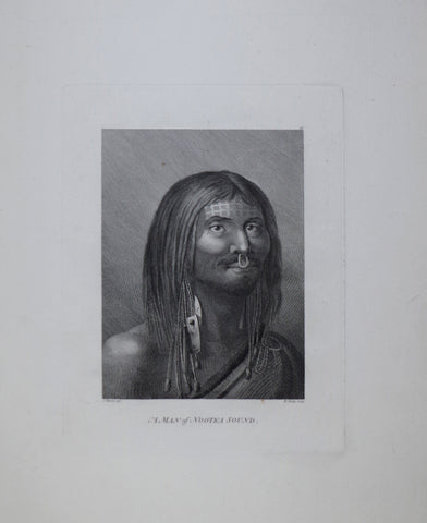
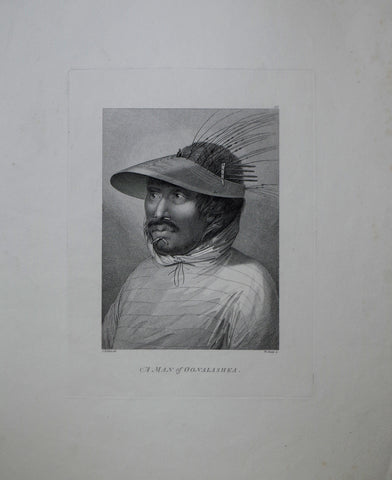
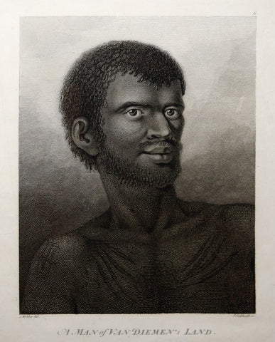
The superb copper-engraved prints were made from the drawings of the young Swiss artist, John Webber. The 24-year-old painter had been educated in Berne and Paris and came to the attention of the Admiralty after exhibiting a portrait of his brother at the Royal Academy exhibition of 1776. His figure drawing is the most accomplished of images presented in Cook’s publication, but he was also able to interpret the mass of the landscape and details of the flora and animal life. Moreover, his drawings of ceremonies and spectacles witnessed by the sailors capture the sense of wonder they must have experienced and no doubt were greatly responsible for the success of the publication.