CHORIS, Louis (1795-1828). Vue du port d'Ounalaschk [Aleutian Islands, Alaska]
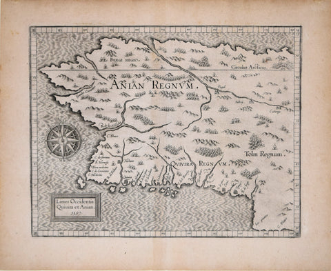
Cornelius van Wytfliet (Flemish, d. 1597), Limes Occidentis Quiuira et Anian - Anian Regnum
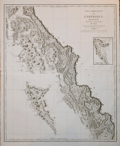
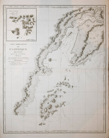
George Vancouver (1757-1798), Cote Nord-Ouest de L'Amerique Reconnue le Cap Vancouver IV Partie
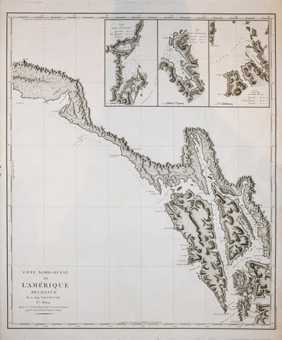
George Vancouver (1757-1798), Cote Nord-Ouest de L'Amerique Reconnue le Cap Vancouver V Partie
George Vancouver (1757-1798), Cote Nord-Ouest de L'Amerique Reconnue le Cap Vancouver VI Partie
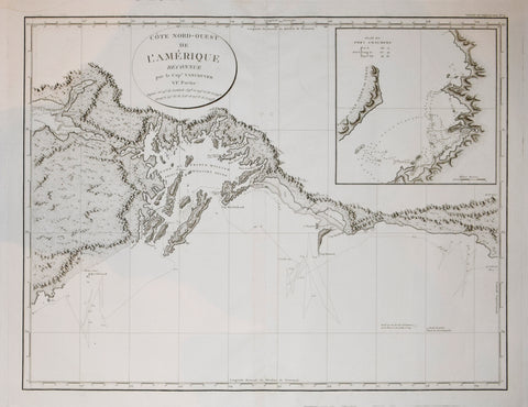
George Vancouver (1757-1798), Cote Nord-Ouest de L'Amerique Reconnue le Cap Vancouver VII Partie
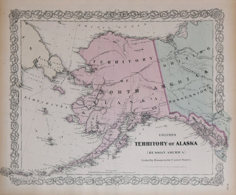
George W. Colton (1827-1901) and C.B. Colton, Colton's Territory of Alaska (Ceded by Russia to the United States)
Jean François de Galaup, comte de Lapérouse (French, 1741-1788) Plan of the Kurile Islands..from a chart in the Archives of the Ochotsk.. in 1788. No.69 [Russian Far East and Japan]
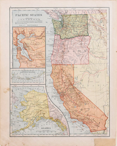
L.L. Poates Engineering Company, Pacific States
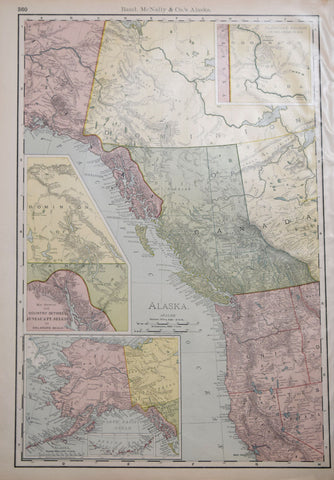
Rand McNally & Co., Alaska
Rand McNally & Co., Map of Alaska
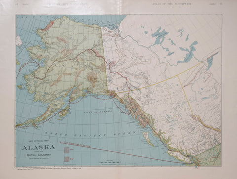
Rand McNally and Company, New Official Map of Alaska Showing also British Columbia with Portion of Alberta
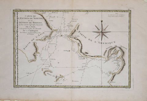
Rigobert Bonne (French, 1727-1795), Carte De L’Entree De Norton et Du Detroit..De L’Amerique
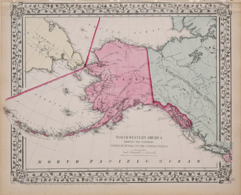
Samuel Augustus Mitchell (1790-1868), North Western America showing the territory ceded by Russia to the United States. (Alaska)
The British Admiralty/ United Kingdom Hydrographic Office Bering Strait...[Alaska, Russia, Artic Ocean]
The British Admiralty/ United Kingdom Hydrographic Office Yukon River to Point Barrow including Bering Strait…[Alaska & Artic Ocean]
![CHORIS, Louis (1795-1828). Vue du port d'Ounalaschk [Aleutian Islands, Alaska]](http://aradergalleries.com/cdn/shop/products/alaska_view_1_large.jpg?v=1634151834)
![Jean François de Galaup, comte de Lapérouse (French, 1741-1788) Plan of the Kurile Islands..from a chart in the Archives of the Ochotsk.. in 1788. No.69 [Russian Far East and Japan]](http://aradergalleries.com/cdn/shop/products/laperouse_kurile_isl_large.jpg?v=1626294603)

![The British Admiralty/ United Kingdom Hydrographic Office Bering Strait...[Alaska, Russia, Artic Ocean]](http://aradergalleries.com/cdn/shop/products/ArcticOcean-BeringStrait_large.jpg?v=1634230518)
![The British Admiralty/ United Kingdom Hydrographic Office Yukon River to Point Barrow including Bering Strait…[Alaska & Artic Ocean]](http://aradergalleries.com/cdn/shop/products/Alaska-YukonRivertoPointBarrow_large.jpg?v=1634229411)