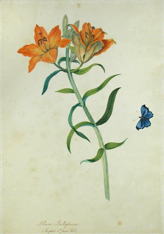
Priscilla Susan Falkner Bury (British, 1799–1872), Lilium Bulbiferum. Fairfield, 6th June, 1825.
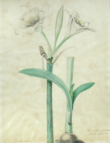
Priscilla Susan Falkner Bury (British, 1799–1872), Pancratium Calathinum. R.H. Esq. April 1831.
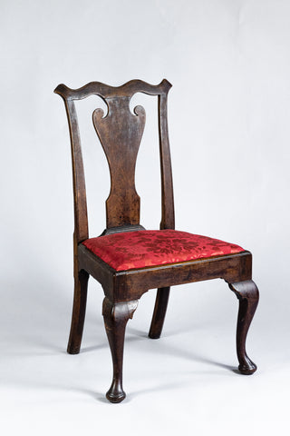
Queen Anne Side Chair (Inv. 0019)
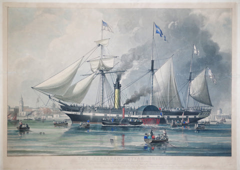
R. G. & A. W. Reese, The President Steam Ship
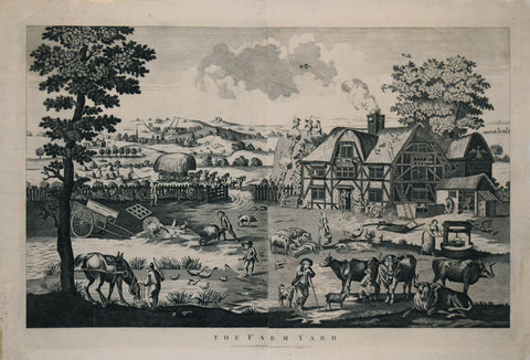
R. Marshall, The Farm Yard
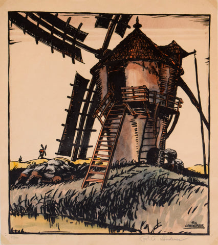
R.A. Loederer (Austrian/American, b. 1894), Windmill
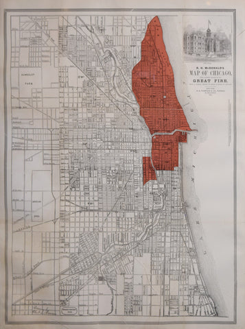
R.H. McDonald, Map of Chicago, with a Correct Outline of the Great Fire, from a careful survey by Sharp and Thain of Chicago
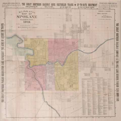
R.L. Polk, Publisher & E.P. Harrison, Surveyor R.L. Polk & Co.’s Map of Spokane, Washington, 1898
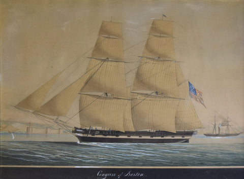
Raffael Corsini (Turkish, act. 1830-1880), Congress of Boston (depicted in the bay of Smyrna)
Ralph E.W Earl (after) Lithograph by Bufford. Andrew Jackson at the Hermitage. Boston: Pendleton's Lithography, [1832]
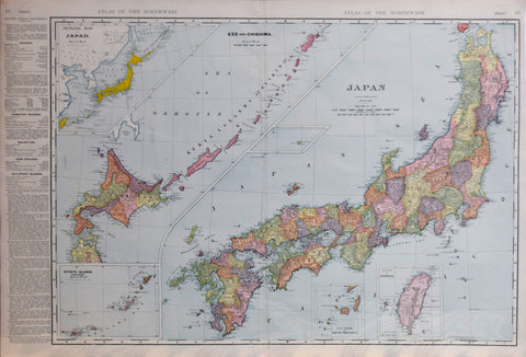
Rand McNally & Co, Japan
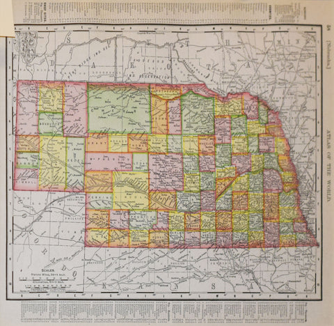
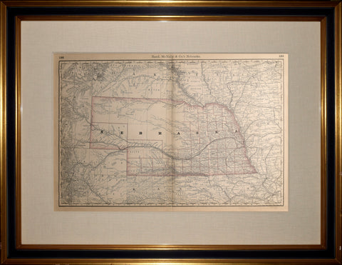
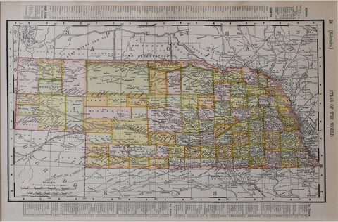
Rand McNally & Co., Nebraska
Rand McNally & Co., Texas [with the Panhandle of Texas, p 67]
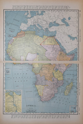
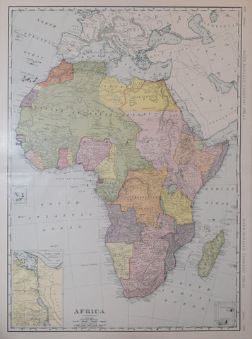
Rand McNally & Co., Africa
Rand McNally & Co., Alaska
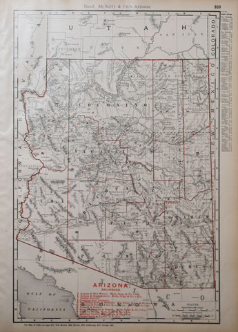
Rand McNally & Co., Arizona with Railroads
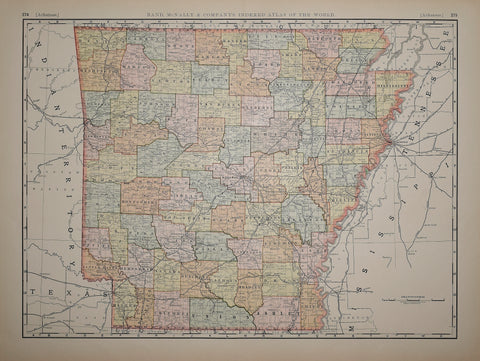
Rand McNally & Co., Arkansas
![Ralph E.W Earl (after) Lithograph by Bufford. Andrew Jackson at the Hermitage. Boston: Pendleton's Lithography, [1832]](http://aradergalleries.com/cdn/shop/products/buffordjackson_large.jpg?v=1612905438)
![Rand McNally & Co., Texas [with the Panhandle of Texas, p 67]](http://aradergalleries.com/cdn/shop/products/Texas-_Rand_McNally_p67_large.jpg?v=1488404757)