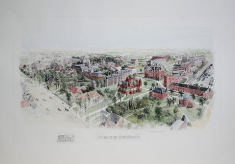
Princeton University
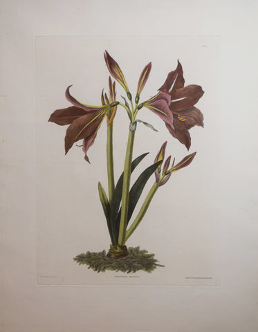
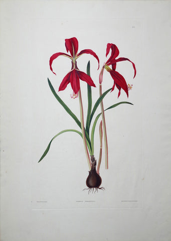
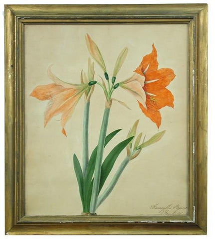
Priscilla Susan Bury (1799-1872), Amaryllis Regina 24
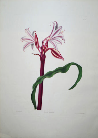
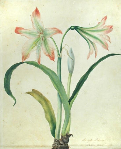
Priscilla Susan Bury (1799-1872), Amaryllis Belladonna 45
Priscilla Susan Bury (1799-1872), Amaryllis Formosissima 6
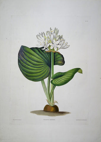
Priscilla Susan Bury (1799-1872), Amaryllis Longifolia 42
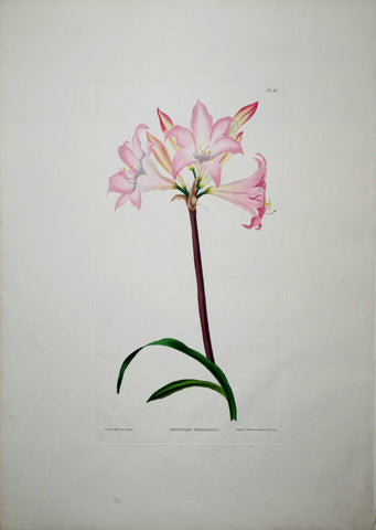
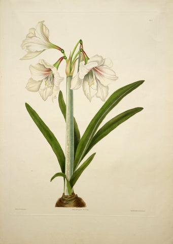
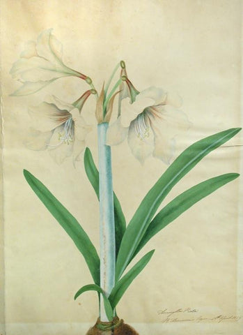
Priscilla Susan Bury (1799-1872), Amaryllis Picta 5
Priscilla Susan Bury (1799-1872), Crinum Hybridum Pedunculatim, Zeylanicum 30
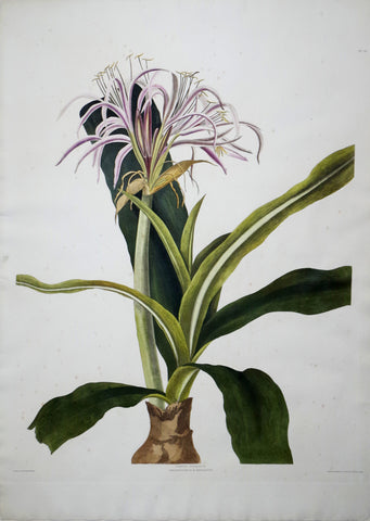
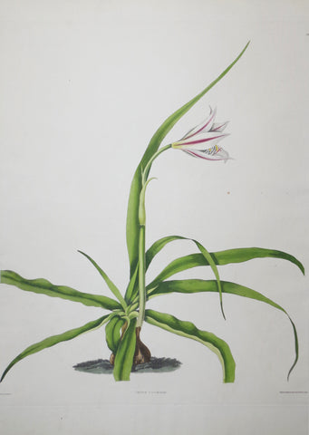
Priscilla Susan Bury (1799-1872), Crinum Yuccaedes 21
Priscilla Susan Bury (1799-1872), Crinum Zeylanicum 29
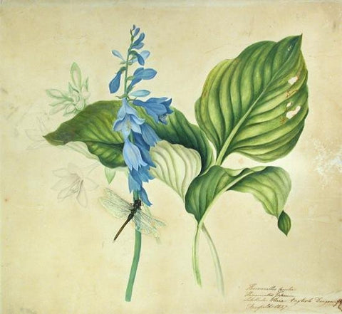
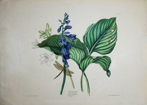
Priscilla Susan Bury (1799-1872), Hemerocallis Carulea 50
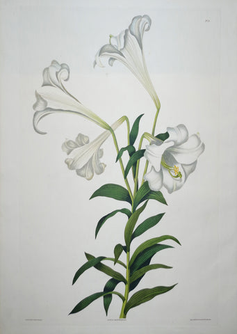
Priscilla Susan Bury (1799-1872), Lilium Longiflorum 8
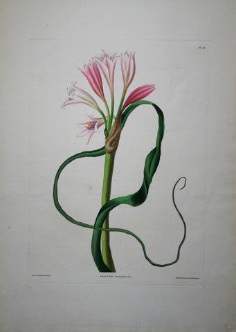
Priscilla Susan Bury (1799-1872), Pancratium Amboinense 20
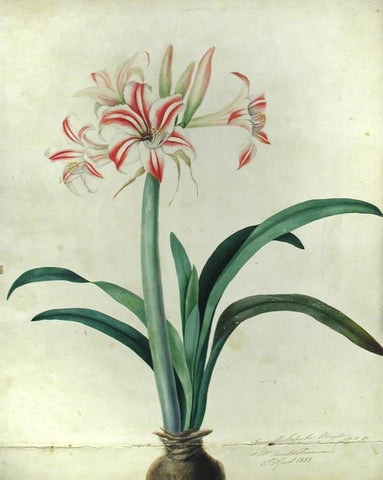
Priscilla Susan Falkner Bury (British, 1799–1872), Amaryllis Picta. R. Harrison’s Esquire 16th April 1829.
Priscilla Susan Falkner Bury (British, 1799–1872), Amaryllis Psitticina. Liverpool: Botanic Garden.
Priscilla Susan Falkner Bury (British, 1799–1872), Amaryllis Reginae. Fairfield, 31 March, 1829.
Priscilla Susan Falkner Bury (British, 1799–1872), Amaryllis Solandriflora: or Amaryllis Johnsoni...
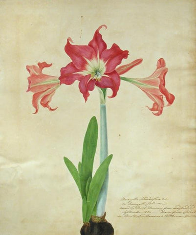
Priscilla Susan Falkner Bury (British, 1799–1872), Amaryllis Superba. Brazil (imported bulb) at Mrs. Arnold Harrison’s 21st April, 1828.
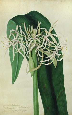
Priscilla Susan Falkner Bury (British, 1799–1872), Crinum Declinaturm. Botanic Gardens 27th March 1829
Priscilla Susan Falkner Bury (British, 1799–1872), Fine Original Album of Botanical Watercolors [1836-1840]
Priscilla Susan Falkner Bury (British, 1799–1872), Hemerocallis Carulea - Hererocallis Japonica - Libellula Varia. English Dragonfly.
![Priscilla Susan Falkner Bury (British, 1799–1872), Fine Original Album of Botanical Watercolors [1836-1840]](http://aradergalleries.com/cdn/shop/products/burybook2_1_large.jpg?v=1592488042)