The Columbian World’s Fair Atlas, N.W. Africa...& Africa
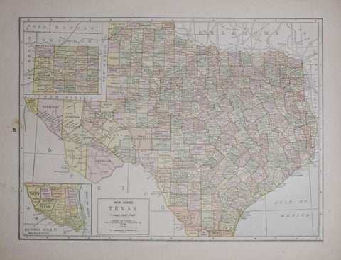
The Geographical Publishing Company, New Series Texas
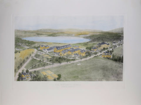
The Hotchkiss School
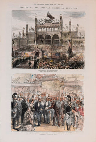
The Illustrated London News, Centennial Hymns and Colonel Sanford Delivering to President Grant
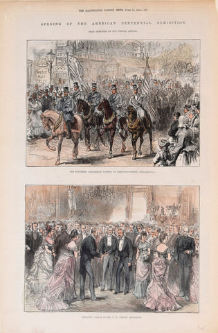
The Illustrated London News, Opening of the American Centennial Exhibition
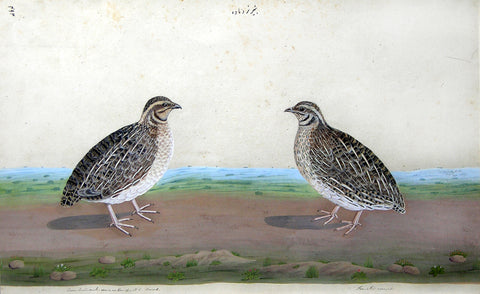
The Lucknow School, A Pair of Common (Eurasian) Quail
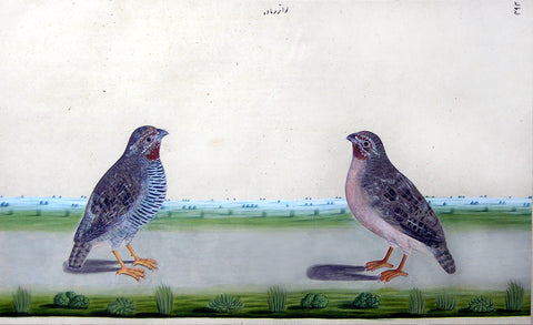
The Lucknow School, A Pair of Jungle Bush-Quail (Perdicula asiatica)
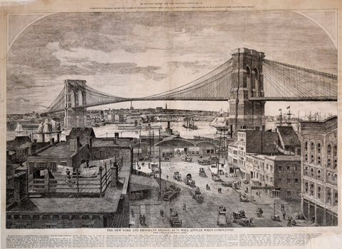
The New York and Brooklyn Bridge as it will appear when completed
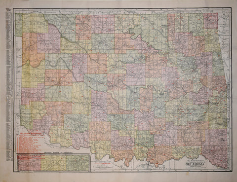
The Rand McNally New Commercial Atlas Map of Oklahoma
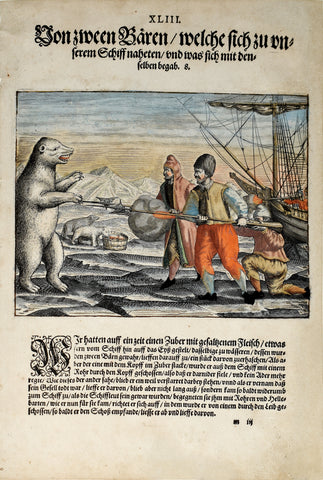
Theodor de Bry (1560-1623) and Johann Israel de Bry (1565-1609), Part III, Plate 43, Two Bears which Approached the Ship and what Happened to Them
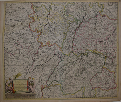
Theodore Danckerts (Dutch, 1663-1727), Accuratissima Rheni Superioris Mosae et Mosellae…
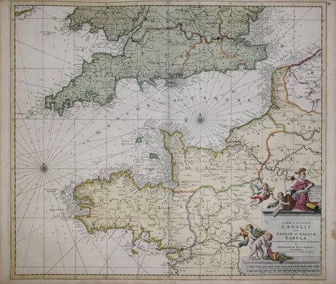
Theodore Danckerts (Dutch, 1663-1727), Novissima et Accuratissima et Angliae et Galliae tabula
Theodore de Bry & Girolamo Benzoni, Occidentalis Americae Partis...
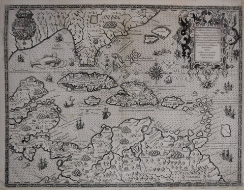
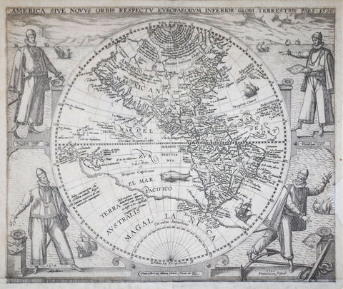
Theodore De Bry (1528-1598) & Girolamo Benzoni (born, Milan, 1519), America sive Novus Orbis Respectv europaervmInferior Globi Terrestris Pars
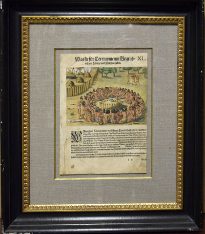
Theodore de Bry (1528-1598), after Jacques Le Moyne, Bastie sur Ceremonien Pl. XL
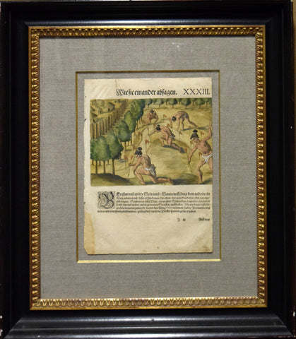
Theodore de Bry (1528-1598), after Jacques Le Moyne, Bietie einander abtagen Pl. XXXIII
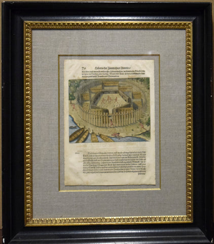
Theodore de Bry (1528-1598), after Jacques Le Moyne, Historia der Innivohner Americae Pl. 70
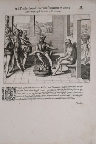
Theodore de Bry (1528-1598), after John White (c. 1540-1593), Ad Praefectum Erreram..III
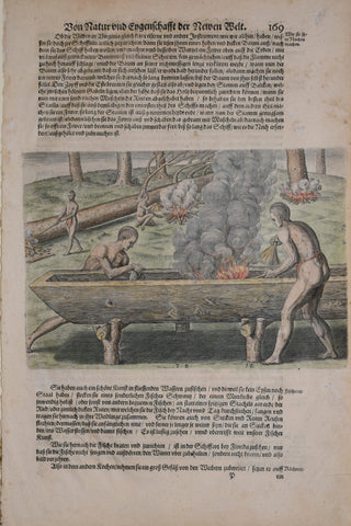
Theodore de Bry (1528-1598), after John White (c. 1540-1593), Bon Natur und Egenschafft.. 169
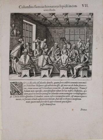
Theodore de Bry (1528-1598), after John White (c. 1540-1593), Columbus fuos cachinnatores..VII