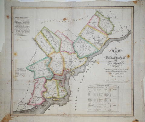
John Melish (1771-1822), Map of Philadelphia County...
John Reed (1887-1920), The Honorable House of Representatives... Map of the City and Liberties at Philadelphia…
John Stobart, Pittsburgh - The Monongahela Waterfront in 1900
Joseph A. Caldwell, Map of Rochester, Beaver Co. PA.
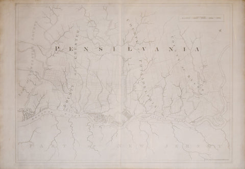
Joseph Frederick Wallet Des Barres (1721-1824), [Pennsylvania], Includes: Part of New Castle County, County of Chester, County of Philadelphia, County of Bucks and Part of New Jersey
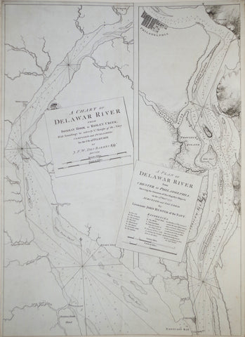
Joseph Frederick Wallet Des Barres (1722--1824), A Chart of the Delaware River from Bombay Hook to Ridley Creek...
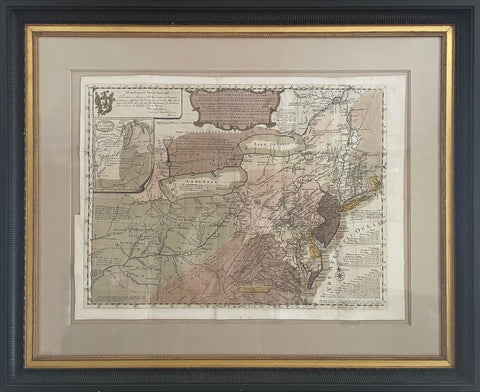
Joseph Frederick Wallet Des Barres (1722-1824), Pennsylvania and surrounding Counties
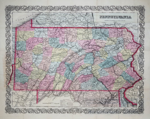
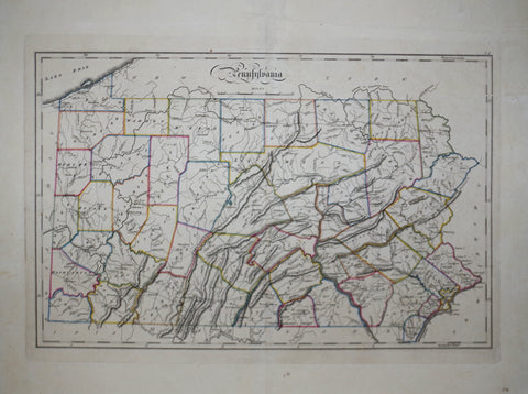
Joseph H. Colton (1800-1893), Pennsylvania
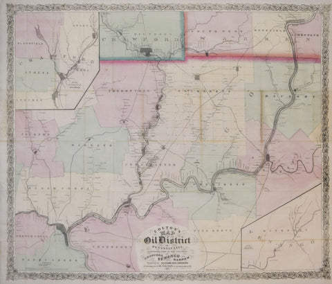
Joseph Hutchins Colton (1800-1893), Colton’s Map of the Oil District of Pennsylvania..Counties of Crawford, Venango and Warren
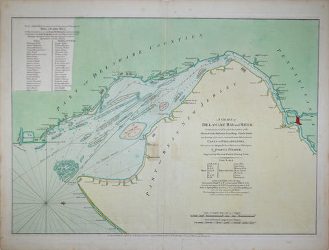
Joshua Fisher (1707-1783), A Chart of Delaware Bay and River containing a full & exact description
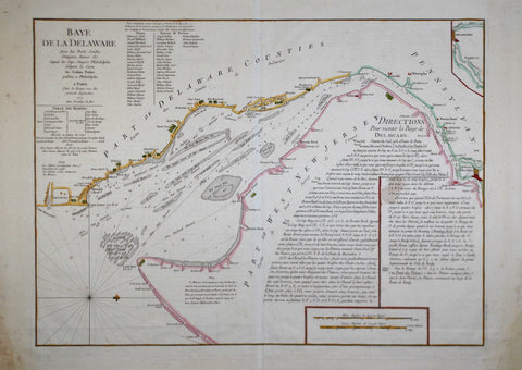
Joshua Fisher (1707-1783), Baye de La Delaware, avec les Portes, Sandes, Dangers...
Joshua Scott Map of Lancaster County Pennsylvania.
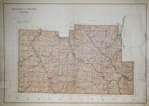
Julius Bien & Co., Allegany and Steuben Counties
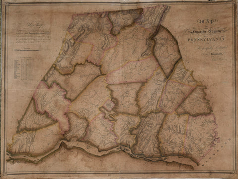
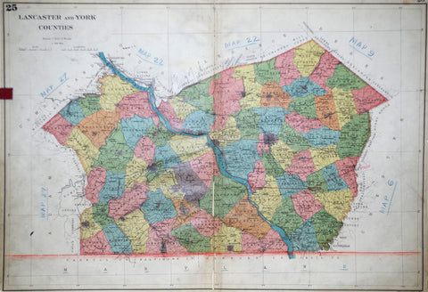
Julius Bien & Co., Lancaster and York Counties
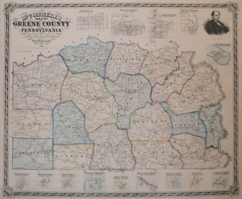
L. McConnell, McConnell’s Map of Greene County Pennsylvania…
Lewis Evans (1700-1756), A General Map of the Middle British Colonies, in America...
Mathew Carey (1760-1839), Pennsylvania
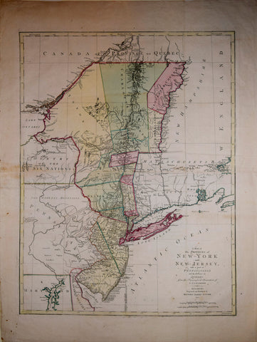
Matthew Albert Lotter (1741-1810), after Claude Joseph Sauthier (1736-1802) A Map of the Provinces of New York and New Jersey with a part of Pennsylvania...
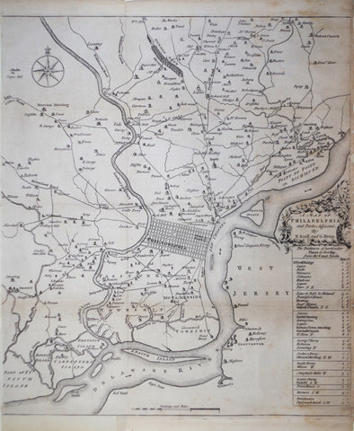
Nicholas Scull (1686-1762) & George Heap (1714-1752), A Map of Philadelphia and Parts Adjacent...
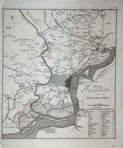
Nicholas Scull (1686-1762) after, Plan der Gegend und Stadt von Philadelphia
![Joseph Frederick Wallet Des Barres (1721-1824), [Pennsylvania], Includes: Part of New Castle County, County of Chester, County of Philadelphia, County of Bucks and Part of New Jersey](http://aradergalleries.com/cdn/shop/products/Pensilvania_large.jpg?v=1490905300)