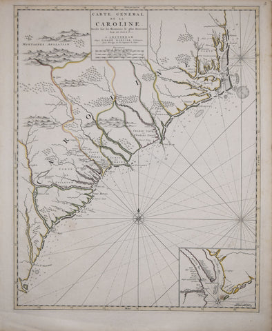
Pierre Mortier (1661-1711), Carte Generale de la Caroline...
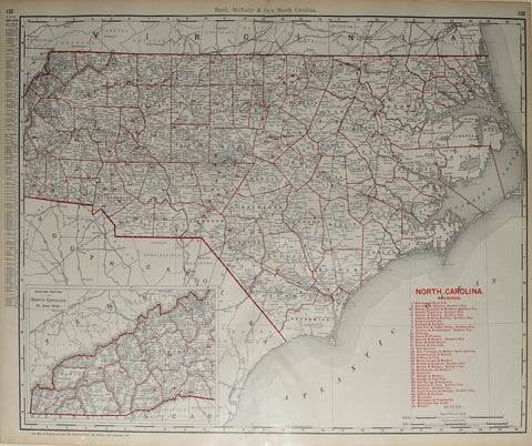
Rand McNally & Co., North Carolina
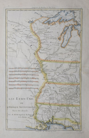
Rigobert Bonne (1727-1795), Les Etats Unis de L’Amerique Septentrionale…
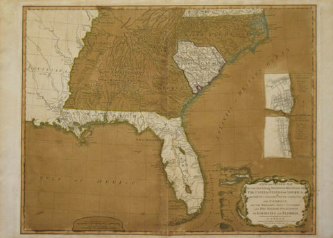
Robert Laurie (C. 1755-1836) & James Whittle (1757-1818) A New and General Map of the Southern Dominion of the United States of America...and the Spanish Possession of Louisiana and Florida.
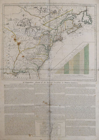
Robert Sayer (1725-1794) & John Bennett (d.1787) publishers, The Theatre of War in North America, with the Roads and Table of Distances…
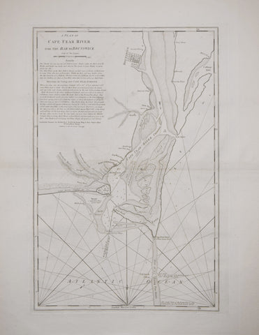
Robert Sayer (1725?-1794) & John Bennett (Fl. 1774-1783, A Plan of Cape Fear River from the Bar to Brunswick...
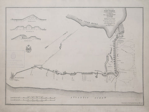
U.S. War Department, Engineer Bureau, Plan and sections of Fort Fisher, carried by assault by the U.S. forces, Maj. Gen. A.H. Terry commanding, Jan. 15th, 1865
Waters & Son, [Map of the Course of the Potomac, from Washington northwest to Fort Frederick; Map of the Cape Fear River, from the Coast inland to Wilmington, North Carolina]
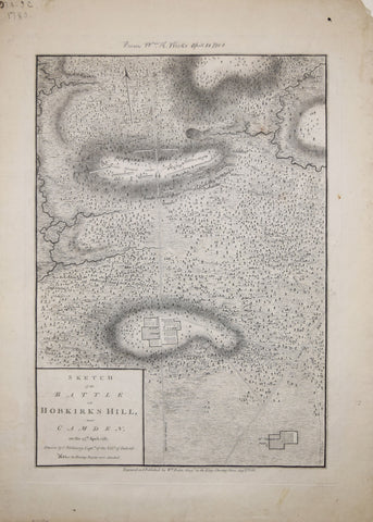
William Faden (1749 – 1836), after Charles Vallency, Captn., Sketch of the Battle of Hobkirk’s Hill near Camden on the 25th April, 1781
![Waters & Son, [Map of the Course of the Potomac, from Washington northwest to Fort Frederick; Map of the Cape Fear River, from the Coast inland to Wilmington, North Carolina]](http://aradergalleries.com/cdn/shop/products/Washington_and_Wilmington_large.jpg?v=1488395848)