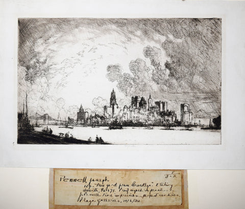
Joseph Pennell (1860 - 1926), New York from Brooklyn
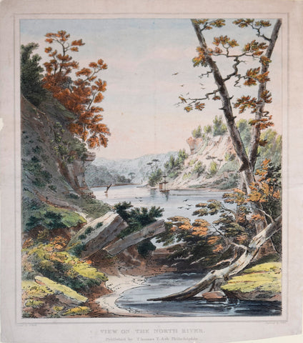
Joshua Shaw (1776-1860), after painting by, View on the North River
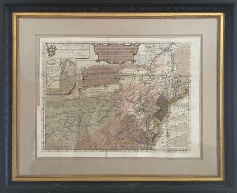
Lewis Evans (1700-1756), A General Map of the Middle British Colonies, in America...
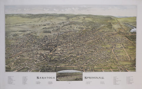
Lucien R. Burleigh (1853?-1923), Saratoga Springs, N.Y.
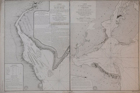
M. de Sartine / Joshua Fisher for George Louis Le Rouge, Carte de la Baye et Riviere de Delaware.../ Carte de L’Entree de la Riviere d’Hudson…
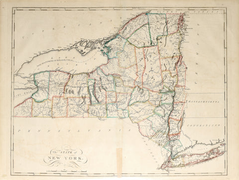
Mathew Carey (1760-1839), The State of New York
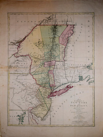
Matthew Albert Lotter (1741-1810), after Claude Joseph Sauthier (1736-1802) A Map of the Provinces of New York and New Jersey with a part of Pennsylvania...
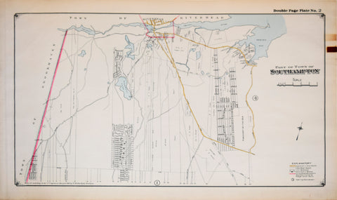
Merritt B. Hyde, Surveyor, Part of Town of Southampton, Plate 2
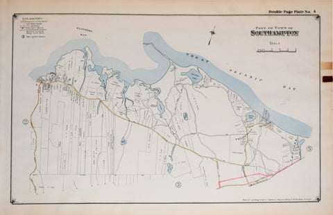
Merritt B. Hyde, Surveyor, Part of Town of Southampton, Plate 4
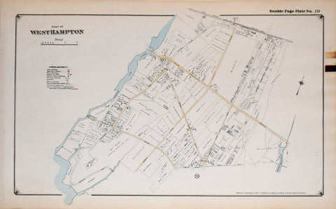
Merritt B. Hyde, Surveyor, Part of West Hampton, Plate 19
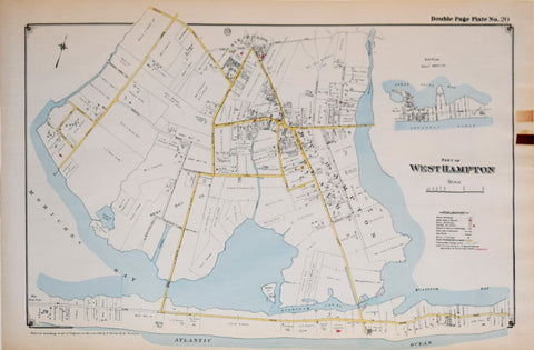
Merritt B. Hyde, Surveyor, Part of West Hampton, Plate 20
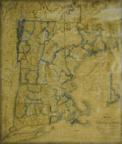
Nathan Hale (1784-1863), A Map of the New England States, Maine, New Hampshire, Vermont, Massachusetts, Rhode Island, Connecticut With the adjoining parts of New York & Lower Canada
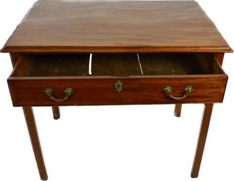
New York Bureau Table (Inv. 0300)
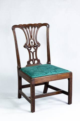
New York Chippendale Side Chair (Inv. 0010)
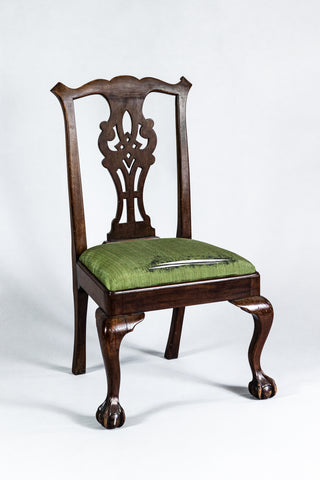
New York Marlborough Leg Side Chair (Inv. 0017)
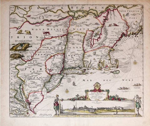
Nicolaes Visscher I (1618-1679), Novi Belgii Novaeque Angliae nec non Virginiae Tabula...
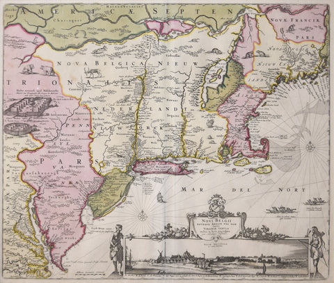
Nicolaes Visscher II (1649–1702), Novi Belgii Novaeque Angliae Nec Non partis Virginiae Tabula multis in locis emendata . . .
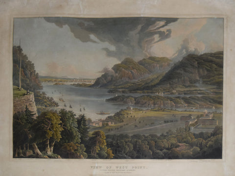
Robert Havell Jr. (1793–1878), View of West Point, United States Military Academy
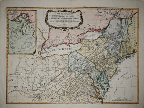
Robert Laurie (1755-1836) & James Whittle (1757-1818), A New and General Map of the Middle Dominions belonging to the United States of America…
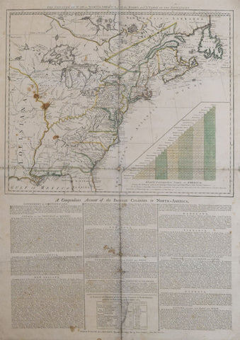
Robert Sayer (1725-1794) & John Bennett (d.1787) publishers, The Theatre of War in North America, with the Roads and Table of Distances…