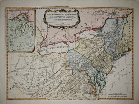
Robert Laurie (1755-1836) & James Whittle (1757-1818), A New and General Map of the Middle Dominions belonging to the United States of America…
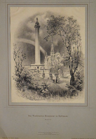
Rudolf Cronau (1855-1939) Das Washington - Monument in Baltimore. Maryland. 19
Samuel Augustus Mitchell (1790-1860), No. 10 Mitchell’s Series of Outline Maps for the use of Academies and Schools [Virginia / Maryland / District of Columbia]
Samuel Augustus Mitchell (1790-1868), Plan of Baltimore
Simon J. Martenet Martenet’s Map of Cecil County Maryland…
U. S. Government, Map of Reconnaissance Between Baltimore and Philadelphia
Waters & Son, [Part of Pennsylvania & Baltimore Maryland; Charleston, South Carolina and Vicinity]
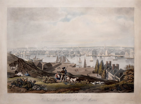
William James Bennett (1787-1844), Baltimore from Federal Hill
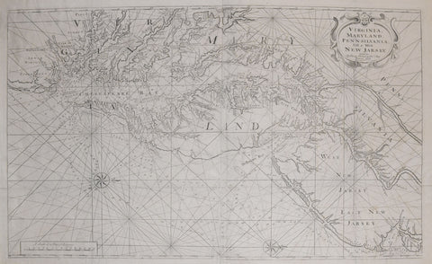
William Mount & Thomas Page, Virginia, Maryland, Pennsilvania, East & West New Jersey
![Samuel Augustus Mitchell (1790-1860), No. 10 Mitchell’s Series of Outline Maps for the use of Academies and Schools [Virginia / Maryland / District of Columbia]](http://aradergalleries.com/cdn/shop/products/No_10_Mitchell_s_Series_of_Outline_Maps_for_the_use_of_Academies_and_Schools_large.jpg?v=1560200733)
![Waters & Son, [Part of Pennsylvania & Baltimore Maryland; Charleston, South Carolina and Vicinity]](http://aradergalleries.com/cdn/shop/products/Pennsylvania_and_Johns_Island_large.jpg?v=1488395997)