Thomas Jefferys (British, 1719-1771), An Authentic Plan of the River St. Lawrence ......Operations of the Seige of Quebec..
Thomas Jefferys (English, 1719-1771), An authentic Plan of the River St. Laurence..with the operations of the Siege of Quebec…[with two inset maps Upper River of St. Laurence & Siege of Quebec]
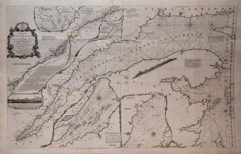
Thomas Jefferys (English, ca. 1719-1771), Exact Chart of the River St. Laurence from Fort Frontenac to the Island of Anticosti...
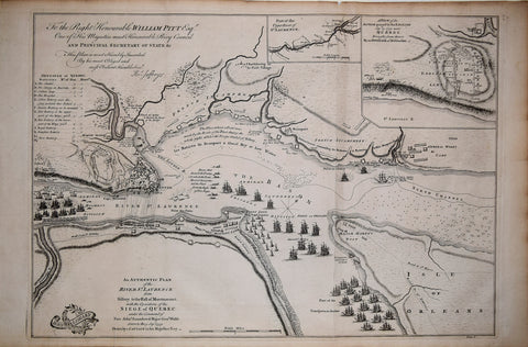
![Thomas Jefferys (English, 1719-1771), An authentic Plan of the River St. Laurence..with the operations of the Siege of Quebec…[with two inset maps Upper River of St. Laurence & Siege of Quebec]](http://aradergalleries.com/cdn/shop/products/An_Authentic_Plan_of_the_River_St_Laurence_large.jpg?v=1488396208)