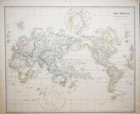
John Arrowsmith (1790-1873) The World on Mercator’s Projection, Pl. 2
John Arrowsmith (1790-1873)
The World on Mercator’s Projection, Pl. 2
From: The London Atlas of Universal Geography
Published, J. Arrowsmith, London, 1840
Engraving with original hand-coloring, includes inset maps of the North and South Poles
Paper size 21 ¾ x 25 ⅜”
p.m. 20 ¾ x 25”
We Also Recommend
![Du Val,Pierre (French, 1618-1683), Le Planisphere Autrement Le Carte Du Monde Terrestre...[In Two Parts]](http://aradergalleries.com/cdn/shop/products/Pierre_Du_Val_large.jpg?v=1467823060)