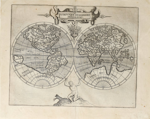
Cornelis van Wytfliet (1555-1597), Utriusque Hemispherii Delineatio (Double Hemisphere world map)
Cornelis van Wytfliet (1555-1597)
Utriusque Hemispherii Delineatio (Double Hemisphere world map)
Histoire universelle des indes, orientales et occidentales.
Douai: François Fabri, 1607
Engraving
9 x 11 3/8" (platemark), 10 5/8 x 13 3/8" (sheet)
This important world map is from Cornelis van Wytfliet's Histoire Universelle des Indes Occidentales. It is the second French edition of “the first separately published atlas devoted to the Americas” (Skelton). Dedicated to King Philip III of Spain and covering the history of the first European encounters with the New World, its geography, and natural history, Wyfliet used as his source the works of Acosta, Hakluyt, de Bry and Ramusio. Wytfliet’s atlas was an immediate success, and six further editions were published over two decades. (Shirley 207)
We Also Recommend

![Du Val,Pierre (French, 1618-1683), Le Planisphere Autrement Le Carte Du Monde Terrestre...[In Two Parts]](http://aradergalleries.com/cdn/shop/products/Pierre_Du_Val_large.jpg?v=1467823060)
