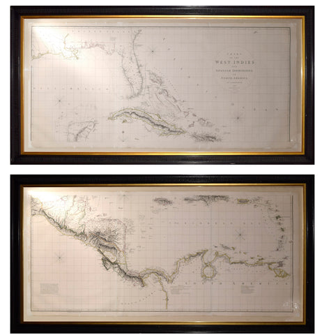
Thomas Jefferys, The Bay of Honduras
Thomas Jefferys
The Bay of Honduras
From Jefferys West India Atlas
London: Robert Sayer, 1775
Sheet size: 21 3/4 x 29 1/4 in.
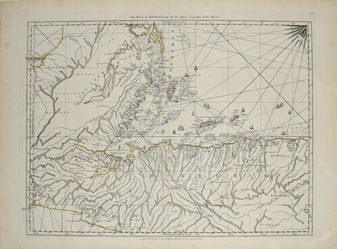
The Bay of Honduras
From Jefferys West India Atlas
London: Robert Sayer, 1775
Sheet size: 21 3/4 x 29 1/4 in.
Shows the coastline from Salamanca de Bacalar to Brewer's Lagoon and the Moskito Coast, centered on the Gulf of Honduras and the Rio Balize. Extends to the Port of Guatemala and La Trinidad on the Pacific Coast, showing numerous volcanoes in the region. The coastline is very detailed, with shoals, islands, soundings and sailing directions and sail ships are used to illustrate navigable routes. Just below Hanover Bay the map indicates "The Logwood Cutters" most likely referring to the lumber industry for Honduran mahogany and rosewood. Many names in both English & Spanish, especially in the regions along the Moskito Coast, where British settlements existed.
We Also Recommend