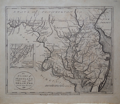
John Payne (1752-1803), The States of Maryland and Delaware, from the Latest Surveys 1799 & inset Map, Continuationof the Potomac River from Fort Cumberland
John Payne (1752-1803)
The States of Maryland and Delaware, from the Latest Surveys 1799 & inset Map, Continuationof the Potomac River from Fort Cumberland
From: New Encyclopedia...
Drawn by John Anderson Jr., Engraved by John Scoles
Published, New York, J. Low, 1799
Engraving
Paper size 8 5/8 x 10 1/4”, p.m. 7 5/8 x 9 1/8”
We Also Recommend


![American School, [Manuscript Map of Pennsylvania]](http://aradergalleries.com/cdn/shop/products/Manuscript_Map_of_Pennsylvania_large.jpg?v=1470162735)