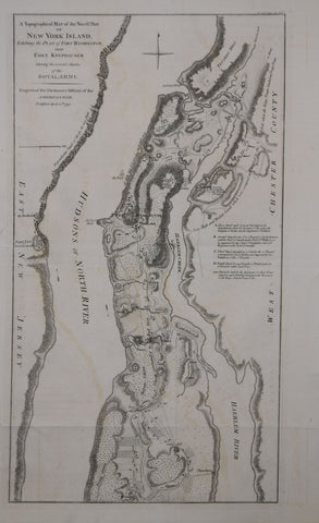
William Faden (British, 1750-1836) and Charles Stedman, A Topographical Map of the North. Part of New York Island Exhibiting the Plan of Fort Washington...
William Faden (British, 1750-1836) and Charles Stedman
A Topographical Map of the North. Part of New York Island Exhibiting the Plan of Fort Washington...
From: Stedman's History of the American War
Published, C. Stedman, London, 1793
Engraving
Paper size: 19 5/8 x 12 5/8"
p.m. 18 3/8 x 10 1/2"
We Also Recommend


