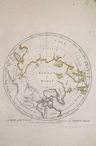
Mathew Carey (1760-1839), Map of the Countries situate about the North Pole
Mathew Carey (1760-1839)
Map of the Countries situate about the North Pole
[First Map of the North Pole made in America]
From: Carey’s General Atlas…
Published, M. Carey, Philadelphia, 1796
Engraving with original outline hand-coloring
Paper size 16 67/8 x 10 ¾”
p.m. 10 x 9 ⅝”
We Also Recommend

![Abraham Ortelius (Flemish 1527-1598), Peruviae Auriferae Regionis Typus [with] La Florida Auctore Hieron Chiaves [with] Guastecan Reg.](http://aradergalleries.com/cdn/shop/products/Peruviae_Auriferae-Ortelius_large.jpg?v=1475527180)
