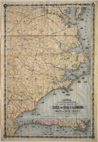
Joseph Hutchins Colton (1800-1893) - Colton's New Topographical Map of the Eastern Portion of the State of North Carolina...
Joseph Hutchins Colton (1800-1893)
Colton's New Topographical Map of the Eastern Portion of the State of North Carolina with part of Virginia and South Carolina... [Inset map lower margin, Plan of the Sea Coast from Virginia to Florida]
Printed by Lang & Cooper, NY, Published, J.H. Colton, 1863
Lithograph with hand-coloring
Image size 39 3/4 x 26 3/8"
We Also Recommend

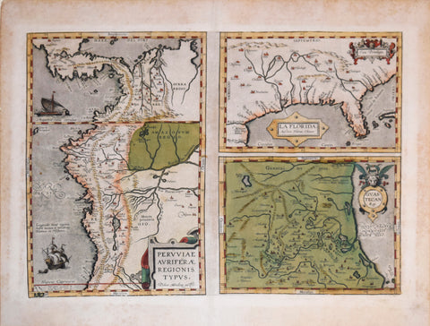
![Abraham Ortelius (Flemish 1527-1598), Peruviae Auriferae Regionis Typus [with] La Florida Auctore Hieron Chiaves [with] Guastecan Reg.](http://aradergalleries.com/cdn/shop/products/Peruviae_Auriferae-Ortelius_large.jpg?v=1475527180)