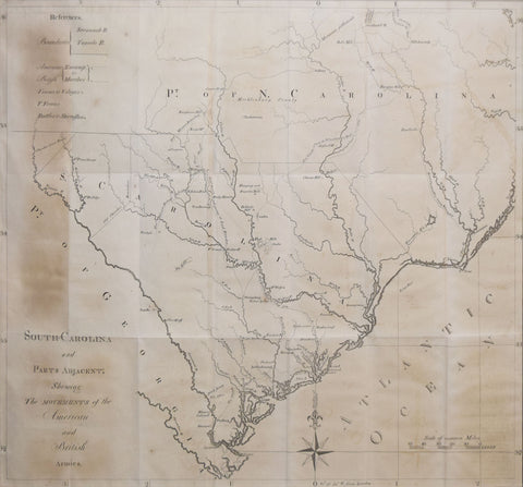
David Ramsay (1749-1815), South Carolina & parts adjacent, showing the movements of the American & British armies
David Ramsay (1749-1815)
South Carolina & parts adjacent, Showing the Movements of the American & British Armies
Published Isaac Collins, Trenton, New Jersey, ca. 1785
Engraving
Image size 19 1/4 x 22 3/8 in.
Frame size 28 x 31 1/4 in.
South-Carolina and Parts Adjacent; Showing the Movements of the American and British Armies shows the activity of the American and British forces in South Carolina and the nearby states, specifically North Carolina, during the American War of Independence. This map includes the advances and retreats of Lord Cornwallis, the British commander in charge of efforts in the South; General Greene, the American general leading the Southern effort; and General Morgan, as well as showing the important battle sites.
We Also Recommend


