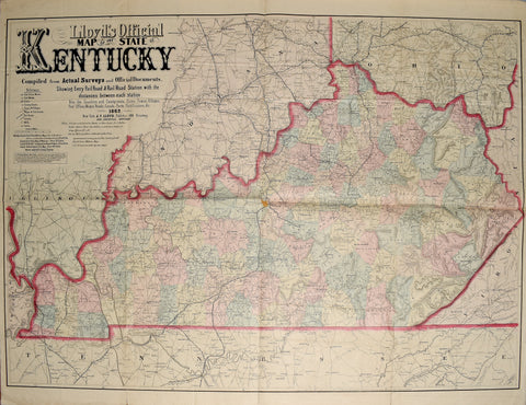
James T. Lloyd, Lloyd's Official Map of the State of Kentucky.
James T. Lloyd
Lloyd's Official Map of the State of Kentucky. Compiled from Actual Surveys and Official Documents, Showing Every Rail Road & Rail Road Station with the Distances Between Each Station. Also the Counties and County Seats, Cities, Towns, Villages, Post Offices, Wagon Roads, Canals, Forts, Fortifications, &c.
Published, New York: J.T. Lloyd, 1862.
Large lithographed map of Kentucky with attractive original hand-color by county.
Sheet size: 34 x 44 in.
We Also Recommend


