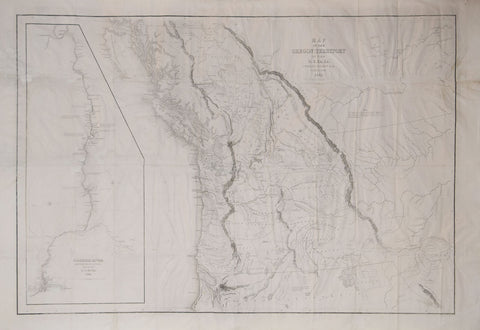
Charles Wilkes (1798-1877), Map of the Oregon Territory.. & Columbia River by Charles
Charles Wilkes (1798-1877)
Map of the Oregon Territory.. & Columbia River by Charles
Wilkes Esqr. Commander
From: Narrative of the United States Exploring Expedition...
Published, Lea & Blanchard, Philadelphia 1841
Engraved by J.H. Young, Sherman & Smith
Engraving
Image size 22 5/8 x 34 1/4”, Paper size 25 3/8 x 38 3/8”
Map of the Oregon Territory.. & Columbia River by Charles
Wilkes Esqr. Commander
From: Narrative of the United States Exploring Expedition...
Published, Lea & Blanchard, Philadelphia 1841
Engraved by J.H. Young, Sherman & Smith
Engraving
Image size 22 5/8 x 34 1/4”, Paper size 25 3/8 x 38 3/8”
We Also Recommend


