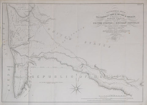
Andrew B. Gray, Topographical Sketch of the Southernmost Point of the Port of San Diego
Andrew B. Gray
Topographical Sketch of the Southernmost Point of the Port of San Diego..determining initial Point of Boundary between the United States and Mexican Republic
John B. Weller, Commissioner
Projected and Drawn by Andrew B. Gray, U.S. Surveyor
Copied by P.M. McGill C. E., Washington, D.C. , ca. 1855
Engraving
Paper size 18 ½ x 23 ¾”
Image size 17 ⅜ x 22 ⅝”
We Also Recommend


