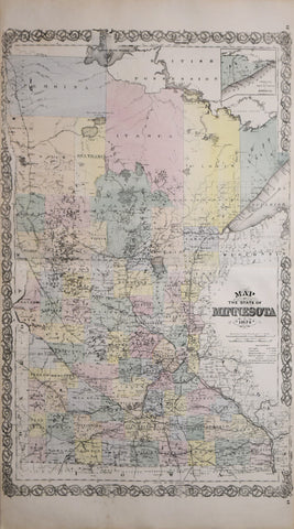
Alfred Theodore Andreas (1839-1900), Map of the State of Minnesota, 1874
Alfred Theodore Andreas (1839-1900)
Map of the State of Minnesota, 1874
Published A.T. Andreas, Chicago, 1874
Printed Chas. Shober Co., proprietors Chicago Lith Co.
Lithograph with hand coloring
Image size: 25 1/4 x 17 in.
Sheet size: 27 3/4 x 17 1/2 in.
Map of the State of Minnesota, 1874
Published A.T. Andreas, Chicago, 1874
Printed Chas. Shober Co., proprietors Chicago Lith Co.
Lithograph with hand coloring
Image size: 25 1/4 x 17 in.
Sheet size: 27 3/4 x 17 1/2 in.
We Also Recommend


