Rigobert Bonne (1727-1795), L'Ancien et Le Nouveau Mexique, Avec La Floride Et La Basse Louisiana. Partie Occidentale
Rigobert Bonne (1727-1795) L'Ancien et Le Nouveau Mexique, Avec La Floride Et La Basse Louisiana. Partie Occidentale from Bonne's Atlas Supplement Published: Paris, c. 1780s Engraving Sheet size: 17 x 11...
$ 350.00 $ 350.00
Samuel Augustus Mitchell (1790-1868), County Map of Utah and Nevada
Samuel Augustus Mitchell (1790-1868) County Map of Utah and Nevada from Mitchell's New General Atlas Published: 1867, Philadelphia, by Samuel Augustus Mitchell Jr. Steel engraving with hand coloring Sheet size: 12 3/4...
$ 250.00 $ 250.00
Samuel Augustus Mitchell (1790-1868), Map of Oregon, Washington and Part of Idaho
Samuel Augustus Mitchell (1790-1868) Map of Oregon, Washington and Part of Idaho from Mitchell's New General Atlas Published: 1860, Philadelphia, by Samuel Augustus Mitchell Jr. Steel engraving with hand coloring Sheet...
$ 675.00 $ 675.00
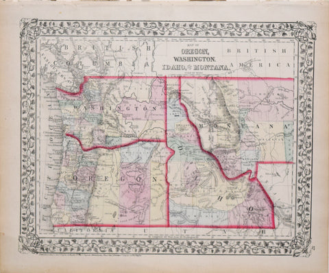
Samuel Augustus Mitchell (1790-1868), Map of Oregon, Washington, Idaho, and part of Montana
Samuel Augustus Mitchell (1790-1868) Map of Oregon, Washington, Idaho, and part of Montana from Mitchell's New General Atlas Published: 1874, Philadelphia, by Samuel Augustus Mitchell Jr. Steel engraving with hand coloring...
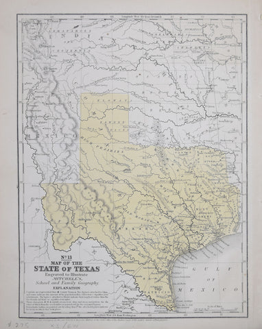
Samuel Augustus Mitchell (1792-1868), No. 13 Map of the State of Texas Engraved to Illustrate Mitchell's School and Family of Geography
Samuel Augustus Mitchell (1792-1868) No. 13 Map of the State of Texas Engraved to Illustrate Mitchell's School and Family of Geography from Mitchell's school atlas: comprising the maps, etc., designed...
$ 850.00 $ 850.00
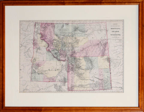
Samuel Augustus Mitchell Jr, County and Township Map Montana, Idaho, and Wyoming
Samuel Augustus Mitchell Jr County and Township Map Montana, Idaho, and Wyoming from Mitchell's New General Atlas, Containing Maps Of The Various Countries Of The World, Plans Of Cities, Etc.... Published: c....
Samuel Scott, Map of Black Hills of South Dakota and Wyoming
Samuel ScottMap of Black Hills of South Dakota and WyomingSamuel Scott Mining Engineer, Custer, South DakotaPublished: Philadelpiha, by E.P. Noll and Co., map publishers 1897LithographPaper size: 31" x 28 1/2" Framed...
$ 3,500.00 $ 3,500.00
Sir Robert Dudley (1574-1649), Carta Particolare Della parte Ocidentale.. La California
Sir Robert Dudley (1574-1649) Carta Particolare Della parte Ocidentale.. La California From: Dell”Arcano del Mare…[Mystery of the Sea] Published, Florence, G. Cocchini, 1661, 2nd state Engraving by Antonio Francesco Lucini....
$ 12,000.00 $ 12,000.00
Texas Engraved Expressly for the World in Miniature.
Texas Engraved Expressly for the World in Miniature.Detailed small-format lithographed pocket map of eastern Texas.Table of Distances to front pastedown.circa 1860Sheet size: 14 x 11 in. folding into original 12mo cloth case...
$ 2,900.00 $ 2,900.00
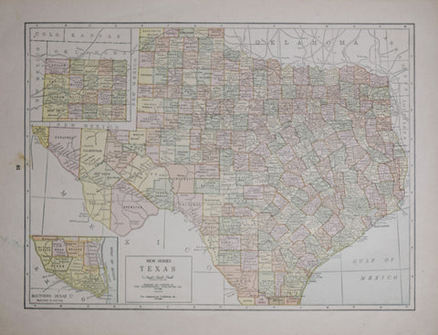
The Geographical Publishing Company, New Series Texas
The Geographical Publishing Company New Series Texas Published by The Geographical Publishing Company, Chicago, c. 1911 Wax engraved, colored Sheet size: 12 x 16"
$ 275.00 $ 275.00
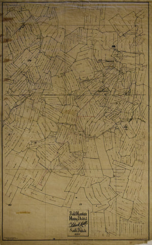
Trojan Mining Company, Bald Mountain Mining District in the Black Hills of South Dakota, 1911
Trojan Mining Company Bald Mountain Mining District in the Black Hills of South Dakota, 1911 Trojan Mining Company, Deadwood, South Dakota, April 10, 1911 Original manuscript map in black ink...
$ 9,750.00 $ 9,750.00
U.S. General Land Office, Dept. of the Interior, State of Montana
U.S. General Land Office, Dept. of the Interior State of Montana S.W. Lamoreux Commissioner, Compiled by Harry King and R.H. Morton Revised and Lettered By I.F. Bethrong Andrew B. Graham,...
$ 3,800.00 $ 3,800.00
United States Coast Survey: A.D. Bache Superintendent, Reconnoissance of the Western Coast of the United States from Monterey to the Columbia River..Sheet No. 1
United States Coast Survey: A.D. Bache Superintendent Reconnoissance of the Western Coast of the United States from Monterey to the Columbia River..Sheet No. 1 Drawing by W.B. McMurtrie Engraved by...
$ 485.00 $ 485.00
United States General Land Office, Map of the Public Surveys in Washington Territory to Accompany Report of Surveyor General 1865
United States General Land Office Map of the Public Surveys in Washington Territory to Accompany Report of Surveyor General 1865 Joseph S. Wilson, Commissioner Published: 1866 by US General Land...
$ 575.00 $ 575.00
United States General Land Office, Map of the Territory of Arizona, 1886
United States General Land Office Map of the Territory of Arizona, 1886 Published, U. S. General Land Office, Washington, D. C., 1886 Photo-lithograph Paper size 20 ⅜ x 16 ½”...
$ 1,200.00 $ 1,200.00
United States General Land Office, State of Oregon
United States General Land Office State of Oregon Fred Dennet, Commissioner Under the Direction of I.P. BerthrongCompiled by M HendgesRevised by A.F. DinsmorePublished, The Eckert Lithographing Co., Washington D.C., 1910Photo-lithographSheet...
$ 1,800.00 $ 1,800.00
United States General Land Office/Charles Roeser, State of California, 1876
United States General Land Office/Charles Roeser State of California, 1876 From: Geographical and political atlas of the states and territories of the United States of America in which the Public...
$ 4,500.00 $ 4,500.00
United States General Land Office/Charles Roeser, State of Oregon
United States General Land Office/Charles Roeser State of Oregon J.A. Williamson, Commissioner Charles Roser, principal draughtsman Photo-lithograph, Julius Bien, NY Published, U.S. General Land Office, Washington, D.C., 1879 Color printed...
$ 2,800.00 $ 2,800.00
United States General Land Office/Charles Roeser, Territory of Arizona
United States General Land Office/Charles Roeser Territory of Arizona J.A. Williamson, Commissioner Charles Roser, principal draughtsman Photo-lithograph, Julius Bien, NY Published, U.S. General Land Office, Washington, D.C., 1879 Color printed...
United States General Land Office/Charles Roeser, Territory of New Mexico
United States General Land Office/Charles Roeser Territory of New Mexico J.A. Williamson, Commissioner Charles Roser, principal draughtsman Photo-lithograph, Julius Bien, NY Published, U.S. General Land Office, Washington, D.C., 1879 Color...