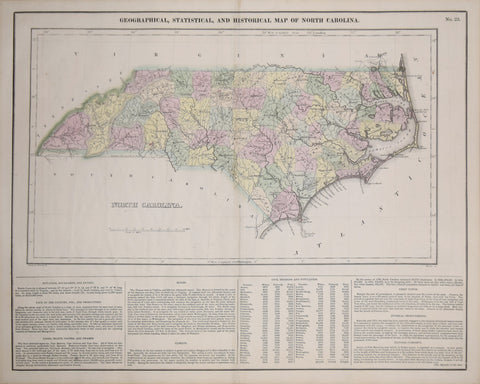
Henry C. Carey (1793-1879) & Isaac Lea (1792-1886), Geographical, Statistical and Historical Map of North Carolina
Henry C. Carey (1793-1879) & Isaac Lea (1792-1886)
Geographical, Statistical and Historical Map of North Carolina
From: A Complete Historical, Chronological, and Geographical American Atlas
Published, Carey & Lea, Philadelphia, 1827
Engraving and letterpress, with
original hand-coloring
Paper size 17 3/4 x 21 7/8”
Image size 16 1/2 x 20 5/8”
We Also Recommend

![Abraham Ortelius (Flemish 1527-1598), Peruviae Auriferae Regionis Typus [with] La Florida Auctore Hieron Chiaves [with] Guastecan Reg.](http://aradergalleries.com/cdn/shop/products/Peruviae_Auriferae-Ortelius_large.jpg?v=1475527180)