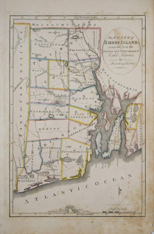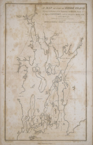
Samuel Lewis (1753-1822), A Map of part of Rhode Island Shewing the Positions of the American and British Armies at the Siege of Newport..1778
Samuel Lewis (1753-1822)
A Map of part of Rhode Island Shewing the Positions of the American and British Armies at the Siege of Newport..1778
From: John Marshall's The life of George Washington
Drawn by S. Lewis, Engraved by Benjamin Jones, Philadelphia
Published, C. P. Wayne, Philadelphia, 1807
Engraving
Paper size 18 x 11 1/4”, Image size with text 17 1/4 x 9 7/8
We Also Recommend