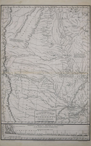
Stephen H. Long, Country drained by the Mississippi Western Section
Stephen H. Long
Country drained by the Mississippi Western Section…
From: An Account of an expedition from Pittsburgh to the Rock Mountains by James Edwin
Maps after the drawings by Stephen H. Long
Published, Carey & Lea, Philadelphia, 1822-23
Engraving by Young & Delleker
Also includes: Vertical section on the Parallel of Latitude 41 Degrees North and 35 Degrees North
Image size of map sections 16 x 10 ¾”, Latitude map 7 ¼ x 11
We Also Recommend