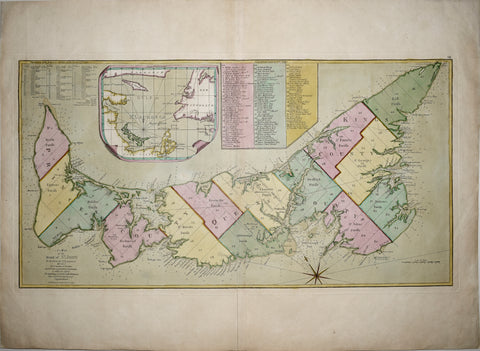
Samuel Holland/Thomas Jefferys, A Map of the Island of St. John In the Gulf of St. Laurence...
Samuel Holland/Thomas Jefferys
A Map of the Island of St. John In the Gulf of St. Laurence Divided Into Counties & Parishes And the Lots as granted by Government, to which is added The Soundings round the Coast & Harbours Improved from the late Survey of Captain Holland . . . 1775
(Prince Edward Island)
London, 1775
Engraving with full original hand-coloring
Sheet: 21 3/4 x 30 1/4 in.
Plate Mark: 15 x 28 in.
We Also Recommend


![American School, [Manuscript Map of Pennsylvania]](http://aradergalleries.com/cdn/shop/products/Manuscript_Map_of_Pennsylvania_large.jpg?v=1470162735)