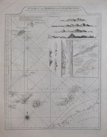
Thomas Jefferys (British, 17191-1771), A Chart of the Madera and Canary Islands…
Thomas Jefferys (British, 17191-1771)
A Chart of the Madera and Canary Islands…[Includes 8 coastal profiles and Plan of El Rio Harbour… & Plan Puerto de Naos and Puerto Cavallo…]
From: The West India Atlas...
Published, Robert Sayer and John Bennett, London, 1787
Copper-plate engraving
Paper size 28 ¼ x 21”
p.m. 25 ½ x 19 ⅜”
We Also Recommend


