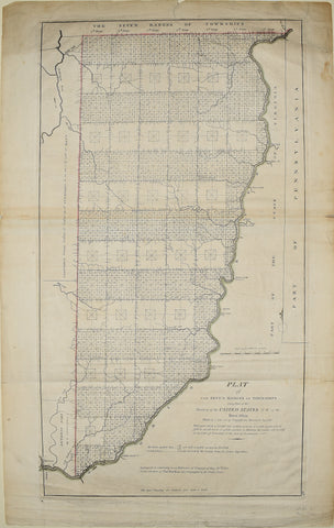
MATHEW CAREY (1760-1839), Plat of the Seven Ranges.. Part of the Territory of the United States N.W. of the River Ohio...
MATHEW CAREY (1760-1839)
Plat of the Seven Ranges.. Part of the Territory of the United States N.W. of the River Ohio...
From: Carey's General Atlas
Published, M. Carey, Philadelphia, 3rd State, post 1799
Engraving with original outline hand-coloring
This map demonstrates the legislated method of settlement that would be used in the areas west of the Ohio River. Carey's printing of the map was in response to a public demand to get an idea of the available lands.
Paper size 26 3/4 x 17 in.
p.m. 24 3/8 x 13 3/4 in.
We Also Recommend


