Mathew Carey (1760-1839), Plat of the Seven Ranges of Townships being Part of the Territory of th United States N.W. of the River Ohio
Mathew Carey (1760-1839)
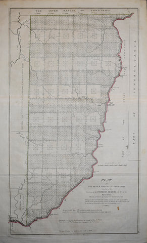
Plat of the Seven Ranges of Townships being Part of the Territory of th United States N.W. of the River Ohio
from Carey's General Atlas, by M. Carey
Surveyed under the direction of Thomas Hutchins (1730-1789) and engraved by William Barker (active 1795-1803)
Published: 1796, Philadelphia
Engraving with outline coloring
Plate mark: 24 1/2 x 13 1/2"
Sheet size: 26 1/4 x 17"
We Also Recommend


