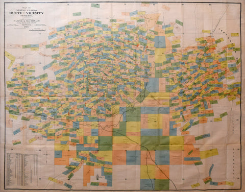
Joseph H. Harper & Malcolm L. MacDonald, Map of the Mining Claims Butte and Vicinity Montana
Joseph H. Harper & Malcolm L. MacDonald
Map of the Mining Claims Butte and Vicinity Montana
Joseph H. Harper, U.S. Land Dept. & Malcolm L. MacDonald, U.S. Deputy Mineral Land Surveyor
The Forman, Bassett, Hatch, Cleveland, O., printers
Compiled and Published Harper & MacDonald, Butte Montana, 1905
Published for: National Railway Comps.
Color printed lithograph
Frame size 33 ¾ x 41 ⅞”
Paper size 29 x 37 ⅛”
Image size 28 ¼ x 36”
We Also Recommend


