Johann Christoph Homann Tabula Geographica Europae Austriacae Generalis....
Johann Christoph Homann
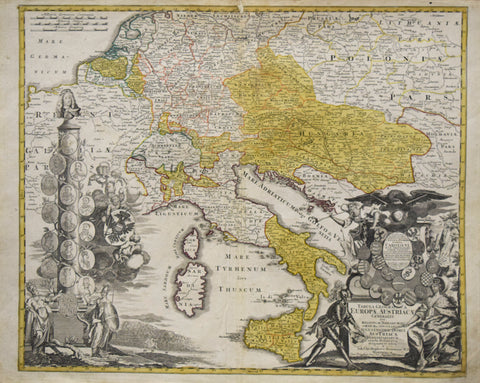
Tabula Geographica Europae Austriacae Generalis....
[Map of the Austrian Empire, including Austria, Hungary, Poland & Italy]
Published, Nuremberg, ca. 1725
Engraving with original hand- coloring
Includes elaborate cartouche with dedication to Carolo VI lower right and a column like form with 16 portraits relating to the Austrian Empire, left margin.
Paper size 20 x 24”
Image size 19 ½ x 22”
We Also Recommend


