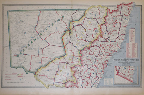
Andrew Garran (1825-1901), editor, Map of New South Wales Showing Territorial Divisions, Land Board Districts, and Land Districts
Andrew Garran (1825-1901), editor
Map of New South Wales Showing Territorial Divisions, Land Board Districts, and Land Districts
from Picturesque Atlas of Australasia
Published: 1886-88, Sydney, by Picturesque Atlas Publishing Co.
Engraved by A. Dulon & L. Poates
Color printed engraving
Sheet size: 17 x 25 1/2"
We Also Recommend


